There are several popular places for tourists to go on Guam. One of them is Two Lover’s Point. As many of you probably know, Guam was invaded by Spain in 1565, and the peaceful Chamorro people who lived on the island were subject to a fairly brutal rule by Spanish conquerors.
During the time of the Spanish occupation of Guam, a ship’s captain took a fancy to a pretty island girl. Unfortunately, this girl was in love with a island boy. When it became clear that she would be married to the Spanish captain against her will, she and her lover jumped off the point together. They felt they would rather die together than live apart.
This brutal story is an odd inspiration for a tourist destination. However, the Japanese and Korean tourists that frequent Guam find it romantic. In fact, many tourists have been married at Two Lover’s Point. Others go to place “love locks” there to declare their undying love for each other.
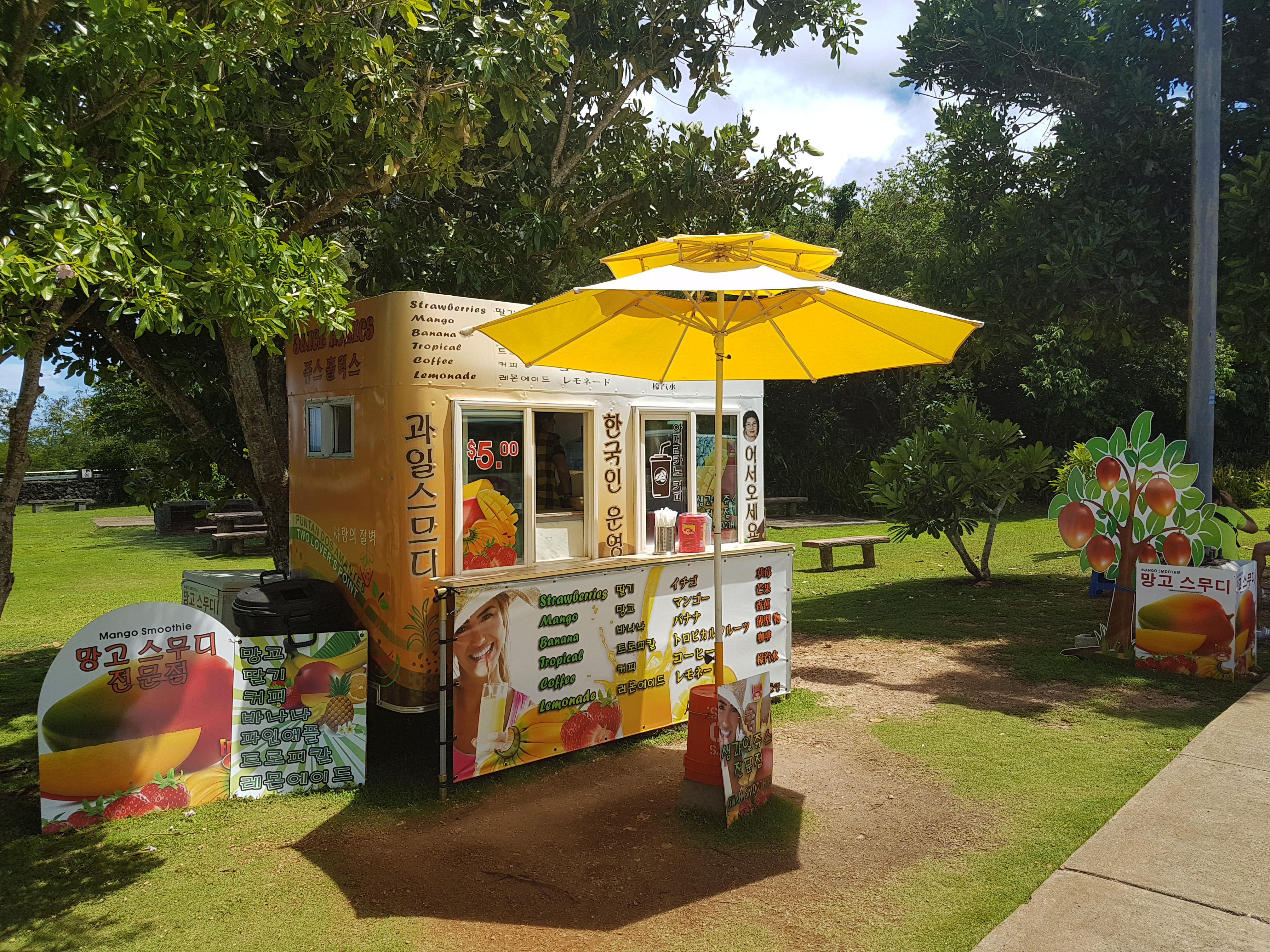
Before I lived in Guam, I spent a little over three years living in South Korea. During that time, I learned to read and write Hangul, which is the Korean written language. That is why I can tell you that this fruit stand is advertising Mango Smoothies, and also the fact that they are Korean people. I assume that is so that the Korean tourists will buy from them instead of from other shops at the point.
In South Korea, I was impressed to find that all the fruit juices were made from real fruit that was blended with ice to make a drink. I had hoped that this stand would be the same, but fresh fruits and vegetables are hard to get on this island. It is made of coral rather than being a volcanic island, and so the soil is not very fertile. As such, all the smoothies are a disappointing blend of ice and flavoring powder.
I hope some day Guam will start to utilize the new technologies available to farm in a sustainable way. Actually, everyone should be doing this since soil nutrient levels have become dangerously low.

The statue here is of two Carabao. A caraboa is an Asian Oxen which was brought to Guam by the very first settlers, the Chamorro people. They are not indigenous, since that title is reserved for animals who evolved on the island. However, they have been on Guam so long that they are considered to be indigenous in the eyes of the locals.
Guam has actually been fighting to get rid of brown tree snakes, toads, rats and other invasive species. However, it is very hard to eliminate a population of animals once they have been introduced. New Zealand wants to try a new gene editing technology, but that is fairly terrifying since containing genetically modified animals is impossible.
Whatever the solution, the caraboa has a safe place on Guam and is seen as part of the cultural heritage of the people. You can find statues of them all over the island.

These are the love locks I mentioned earlier. This tradition of putting love locks in various places it common in many countries across the world. It seems to me that they are always in places like Two Lover’s Point, where there is a little bit of sadness to the location.
Take, for example, the town of Lovelock Nevada. This tiny town is in the middle of the Nevada desert, and really only exists to sustain the strip mine and the prison. The majority of people who travel to Lovelock Nevada are there to see a relative or loved one who is in the prison.
Rather than couples leaving rocks with two sets of handwriting, it is mostly mothers and wives leaving love locks in Nevada, in hopes that they will see their loved ones again some day.
I don’t know how I feel about this tradition, but my husband and I didn’t put our names on a heart and lock it to the point. It seemed morbid somehow, and like it would be a bad omen for our marriage.
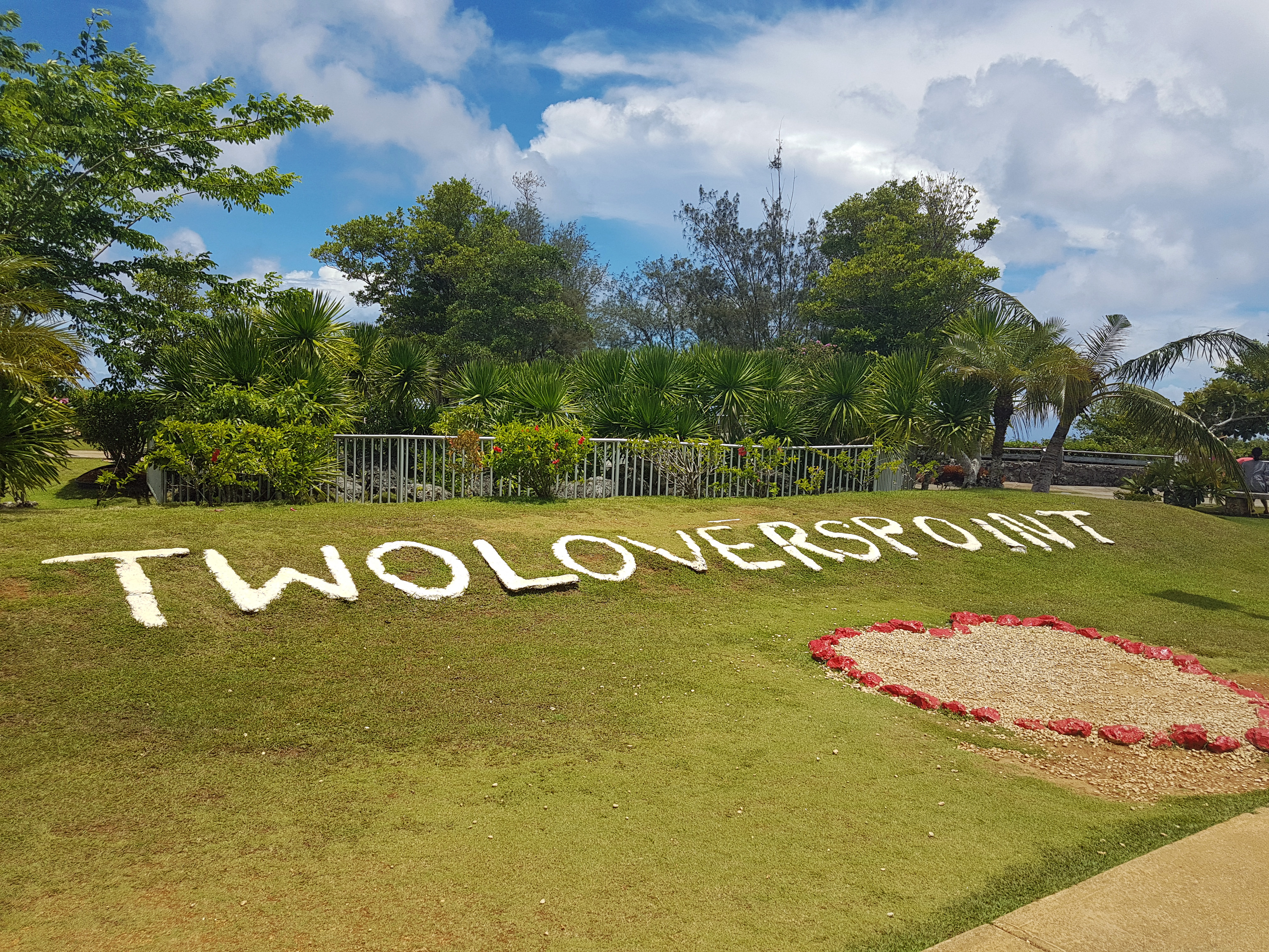
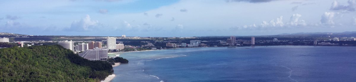
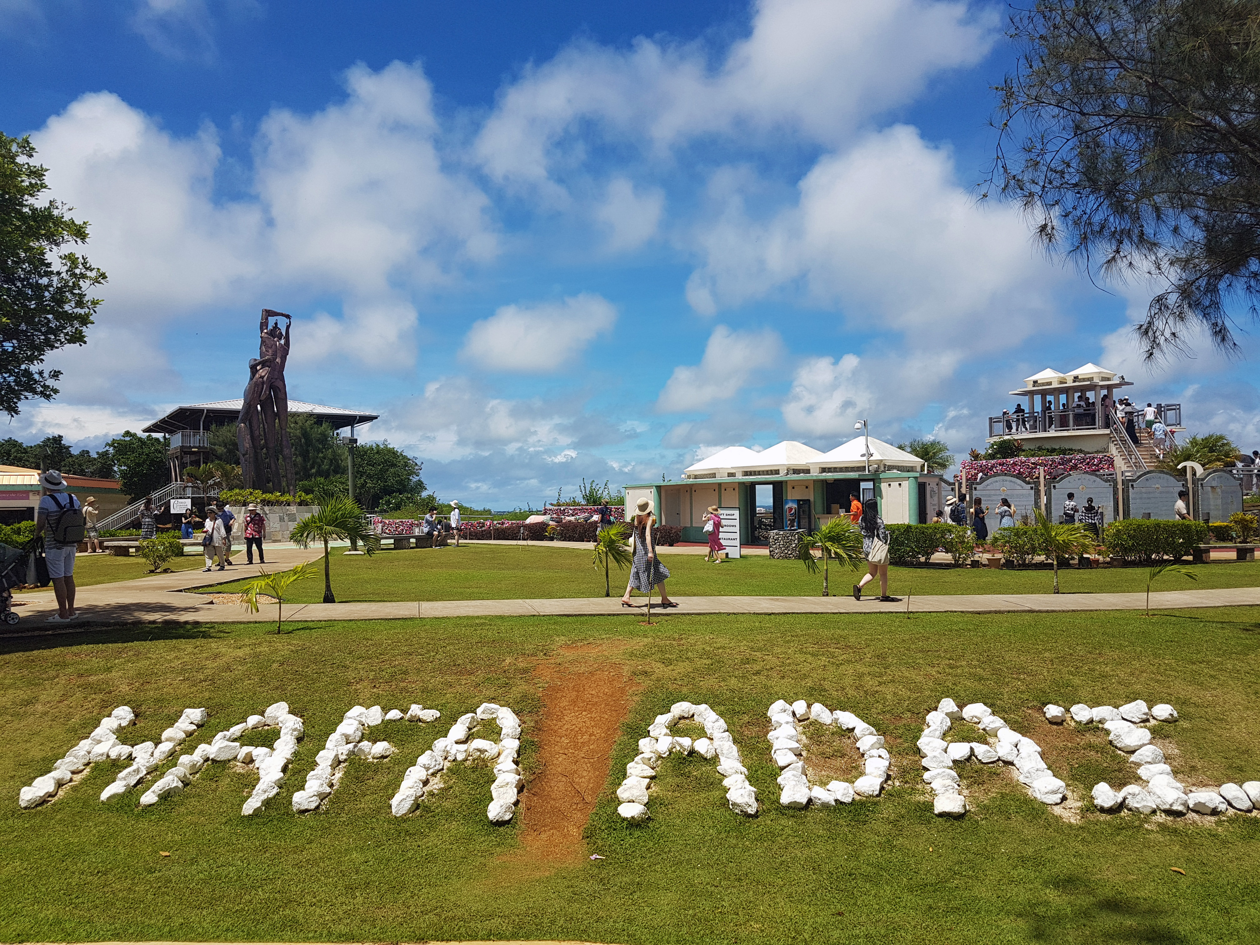
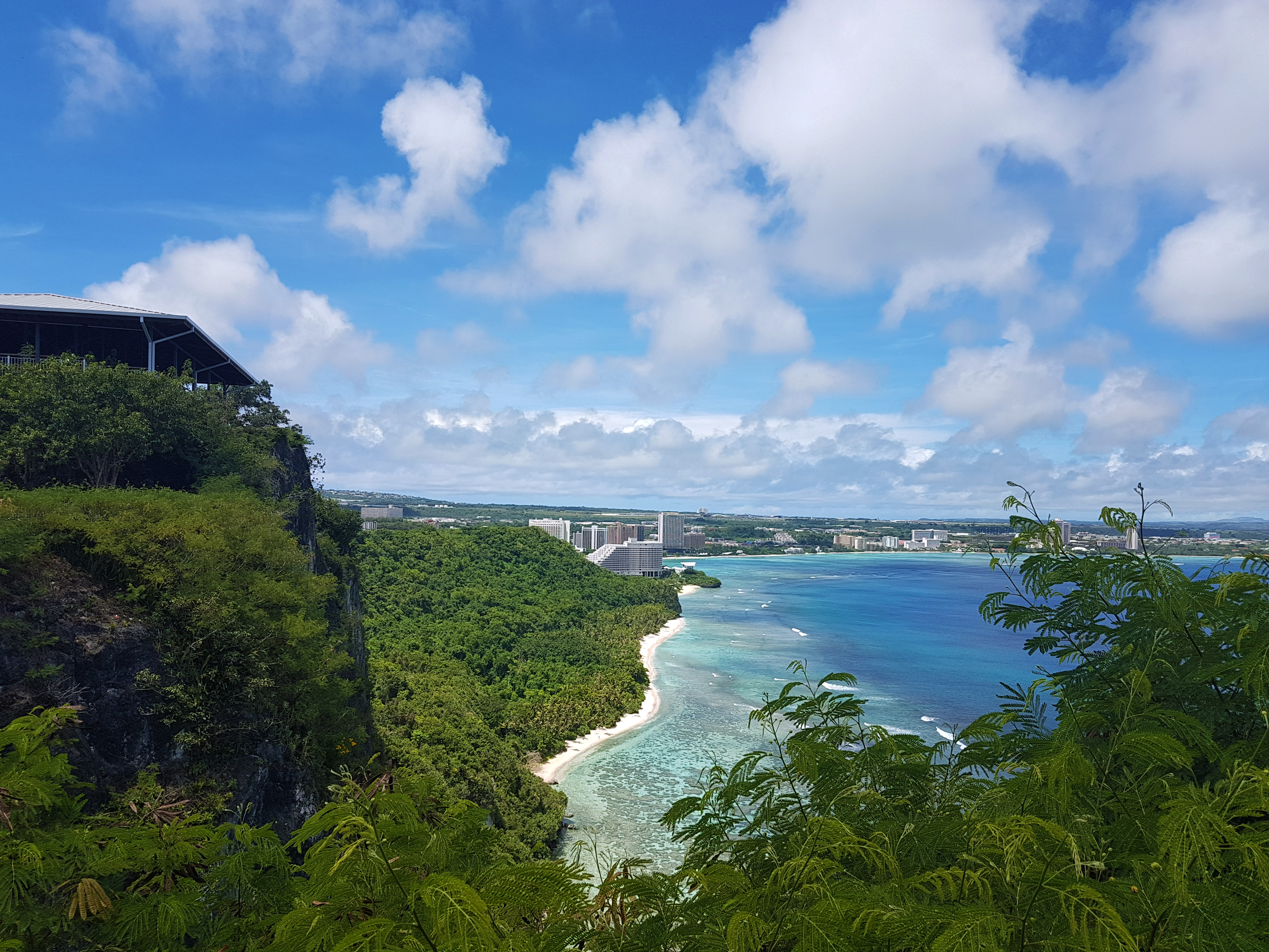
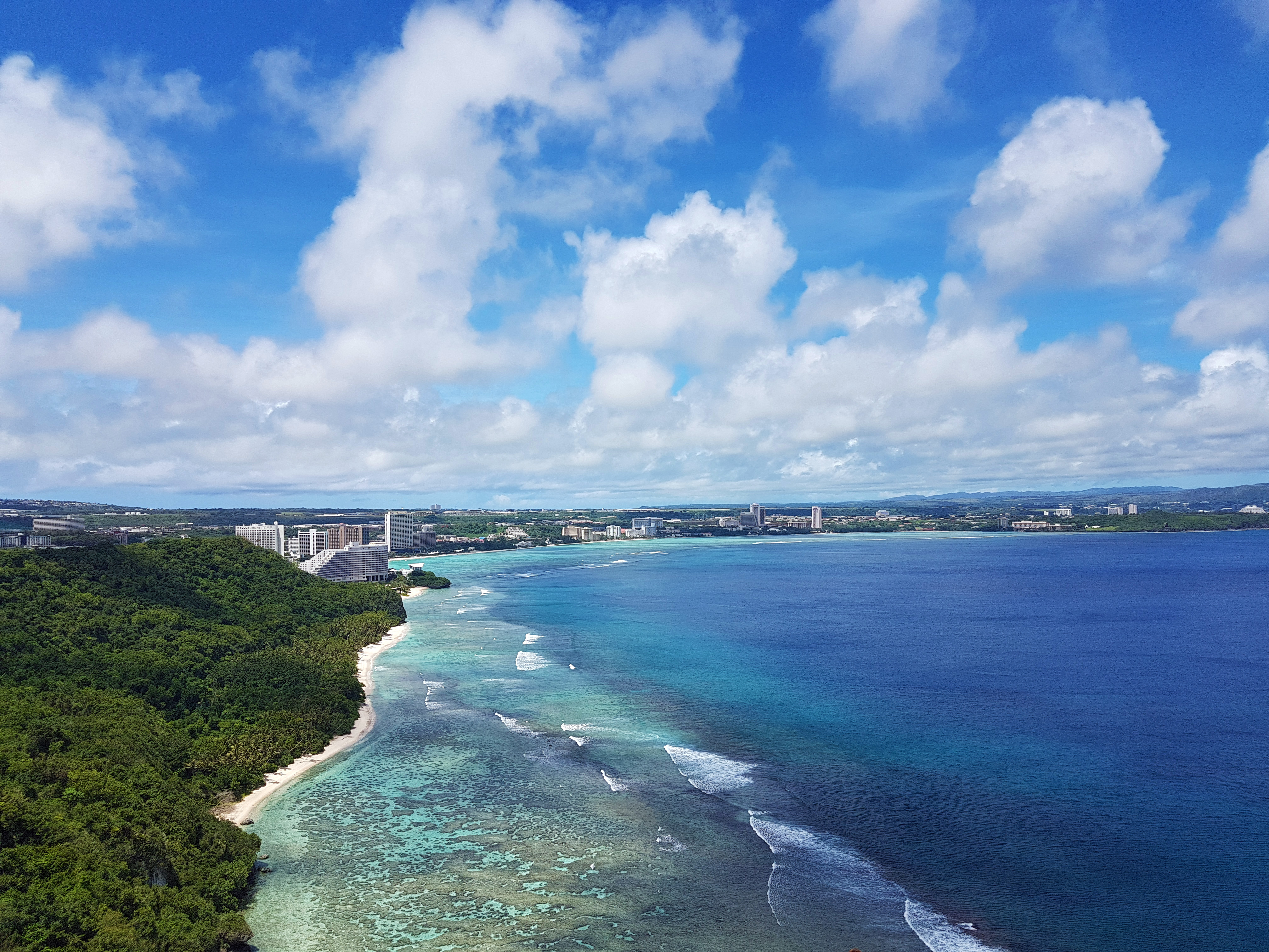
The main reason to go to Two Lover’s Point is for the views. There are several places that are intended to be good photo spots, such as the Two Lovers Point sign (above) and the sign reading “Hafa Adai,” which means “hello” in the local language.
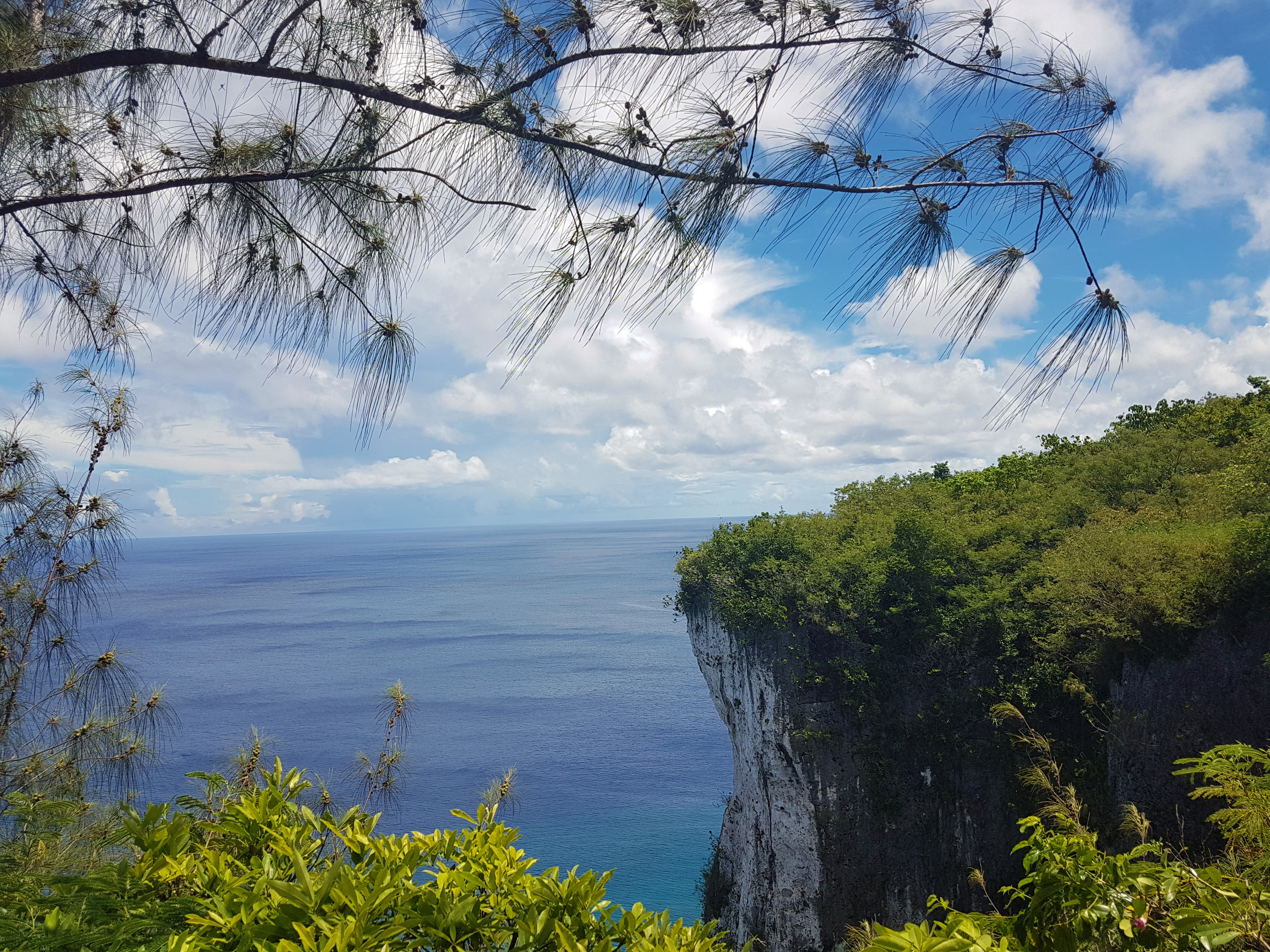
There are a lot of good photo opportunities that are free of charge, and if you do them all, you will have a pretty good album to show off. However, the highest point is behind a pay wall, and you will need to give $5 (or $2 with Guam ID) to the gatekeeper if you want to see that view.
In case you don’t want to spend the money, I have included a picture (later in this post) of what it looks like. You can actually see my house in the picture if you look real close! (We spent the last several years in a building in Tumon Bay called Blue Lagoon.)
If you are already going to Two Lover’s Point, you may as well check out Tanguissen Beach as well. However, I should warn you that it is not something to do in just any car. It is best if you can get a truck or a Jeep, because the road is dangerous and at the bottom, there is quite a bit of driving on dirt.
The turn for Two Lover’s Point off Marine Corpse Drive is marked, and you can easily see the sign. It’s almost directly across the street from Micronesia Mall. You turn, and go down a long road through the jungle. However, there is a second turn that you must make to get to Two Lover’s Point. It’s a left, and there is a HUGE sign to let you know to turn.
In order to get to Tanguissen, just follow that road straight instead of making the right-hand turn. Slow down to about 10 MPR because there is a fair amount of traffic that comes around the blind corners a little too fast, and the potholes seem to jump out of nowhere (and those potholes could shollow up a Smart Car.)
You follow the road until you get to the bottom of the hill. There, you have two choices: You can turn left and continue along some pavement to a power plant, or you can leave the pavement and go straight.
The power plant has been recently retired by the Guam Power Authority, but it is still closed to the public and not safe to explore. It is also not recommended that you swim in the spillway coming from the plant, which no longer dumps hot water into the ocean, but which has dangerous currents and sharp rocks around it.
I like to take pictures around the plant because I think it looks neat, but I have never gotten in the water there.
However, there is a great place to go swimming- it’s just a little tricky. See, the beaches here on Guam are all public property. You cannot actually own a beach. However, you can own the land that a beach is attached to. Tanguissen itself is public, but it is not a good place to swim. However, it is attached to a beach that is nice for swimming, and that beach is attached to private property.
What you do is this: To the right of the beach is a small path along the water. It looks dangerous and like it doesn’t go anywhere, but it does. Just follow that path through the rocks. Make sure you have coral shoes or some other kind of sturdy water shoe.
You’ll come out of the jungle and see a long beach in front of you. If it is high tide, some of your walk will need to be through the water. Do not swim as soon as you get out of the jungle. The water is shallow there and full of very sharp rocks. Just keep walking.

As you walk along the beach, you may want to pick up sea glass. This is a good place to find it, and people tend to use sea glass in all kinds of art projects. There are sometimes shells on the beach as well, but remember: most shells on Guam have animals living in them! Hermit crabs are everywhere on Guam, and it’s best to leave the shells for them.
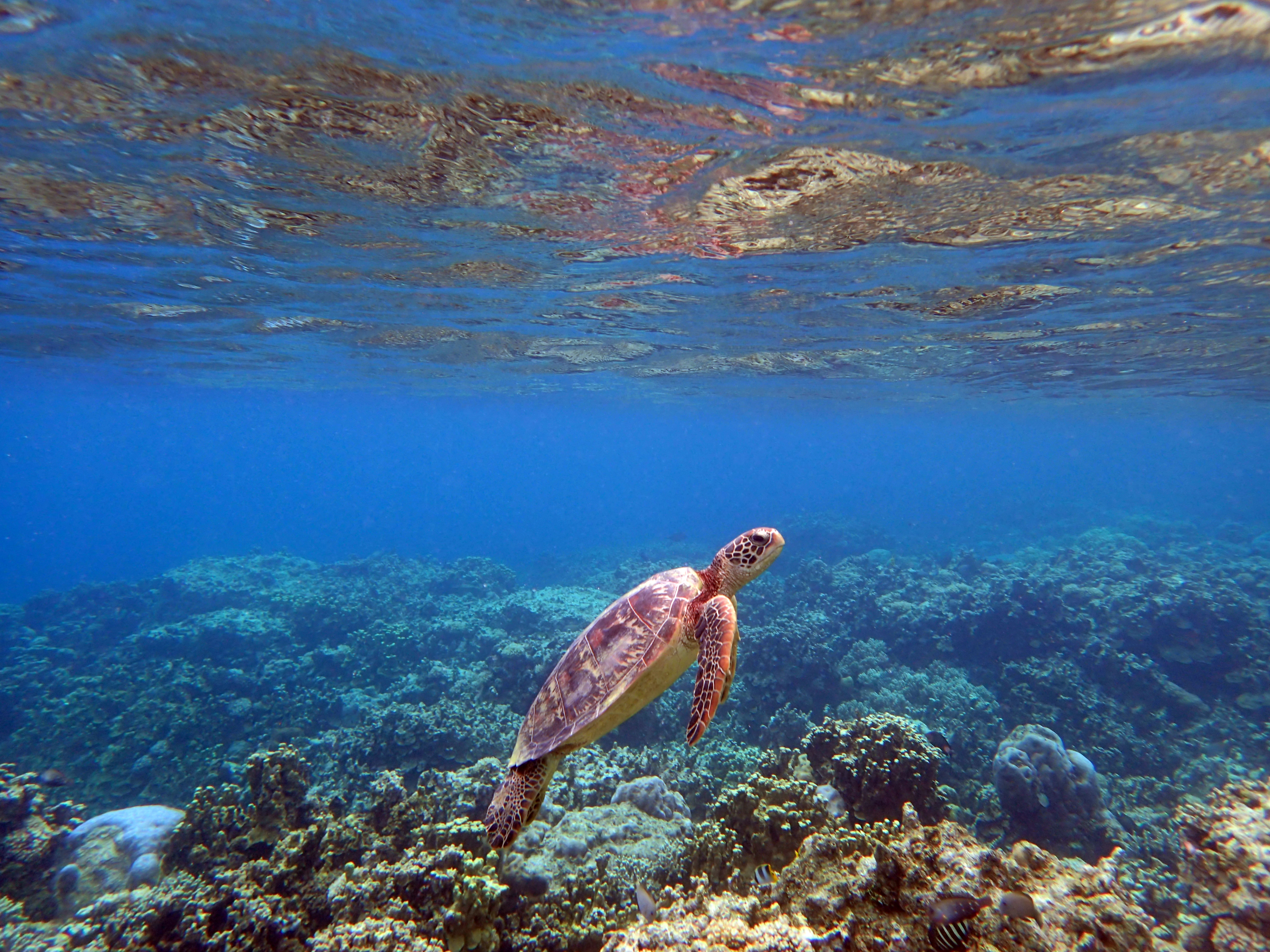
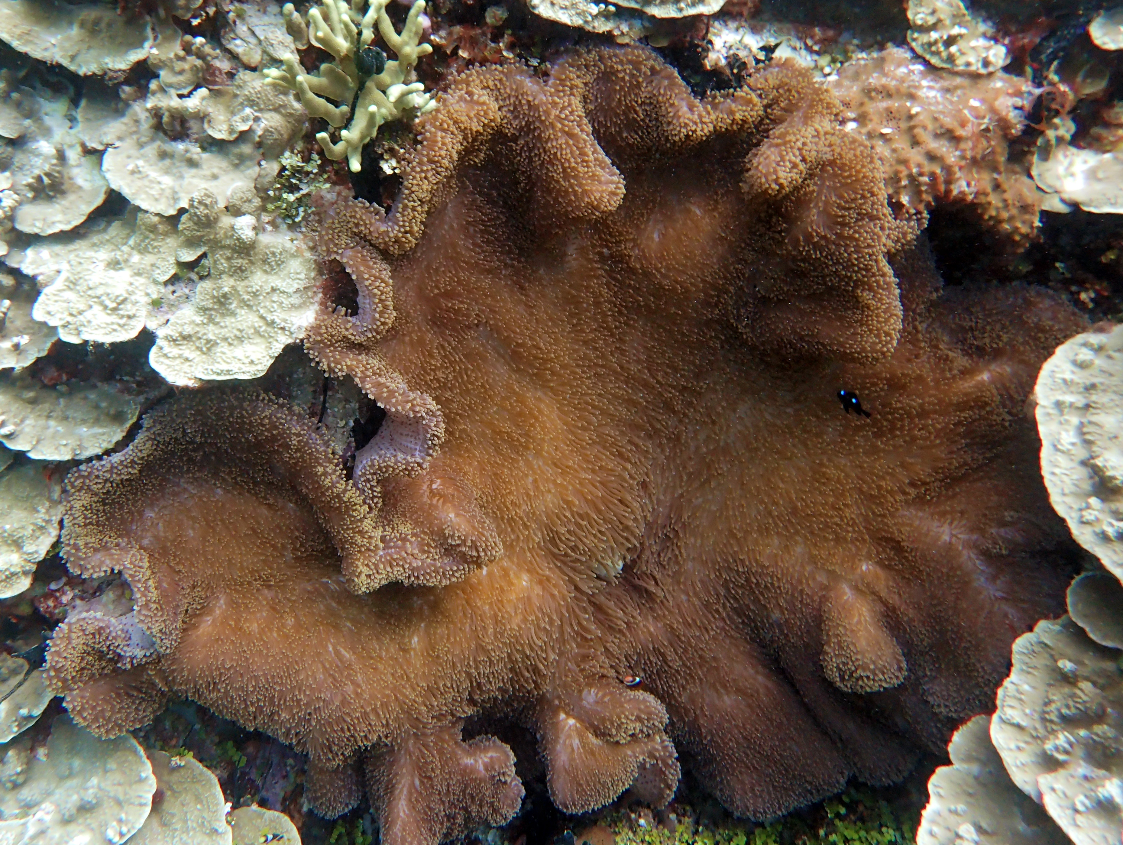
Tanguissen used to have some beautiful stag corals, but they bleached in 2017 and have not grown back. Now, it is mostly algae. However, it is also a good place to see sea urchins and puffer fish.
Fins are not recommended at all if you swim. The water it too shallow and it is best to float while keeping your feet on the ground and walking. This way you will not bump into any of the coral and damage it.
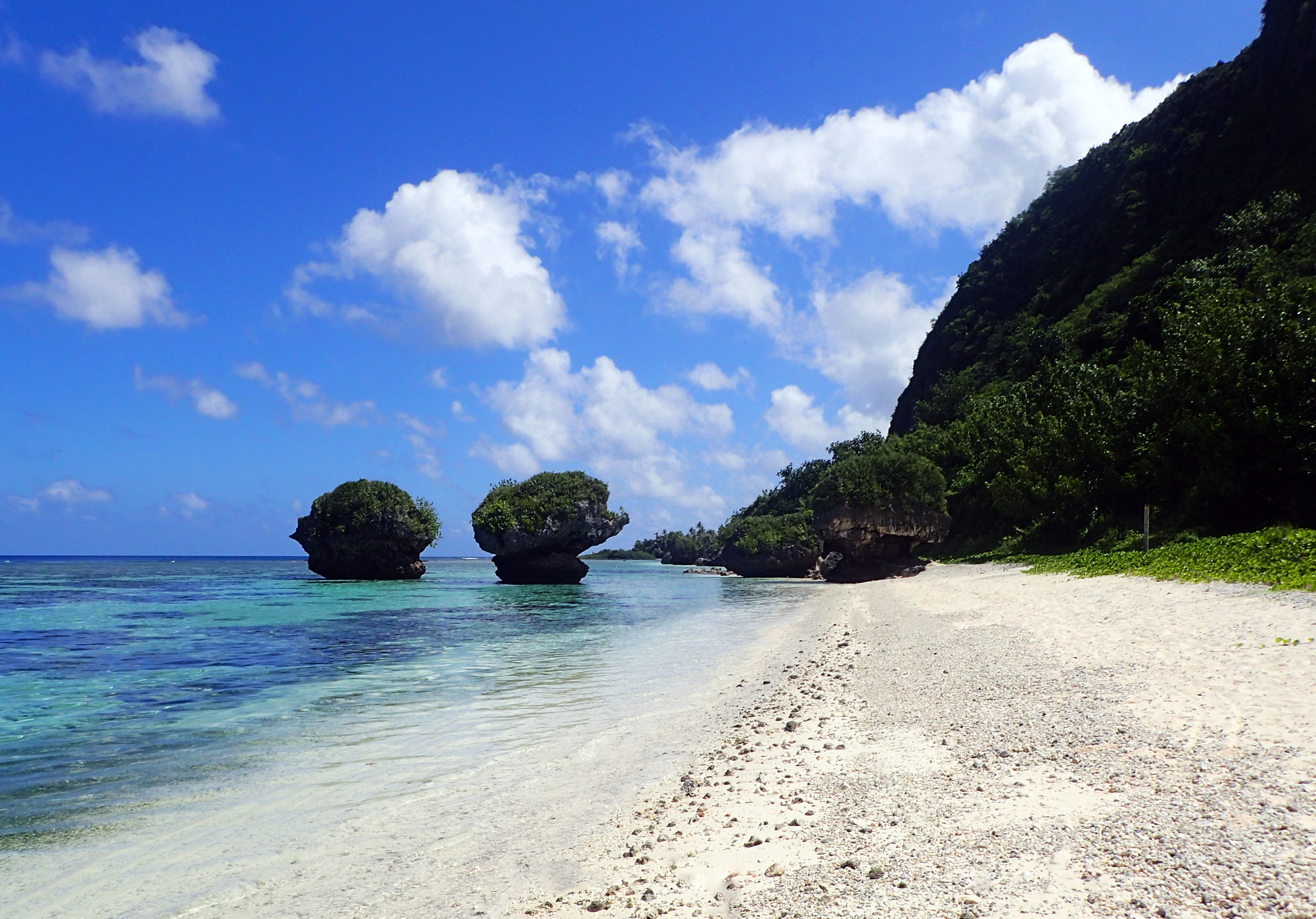
Of course, most people don’t go to Tanguissen to swim; they go for the rocks. The rocks at Tanguissen were once part of the imposing cliffs the line the beach. However, they broke off and fell into the water. They have been eroded by the ocean and watered by the rain, and they have become quite beautiful.
Please remember that if you plan to climb onto turtle rock (the one with a shelf for standing on) that you should walk out in coral shoes, and try to avoid stepping on the coral. Keep your eyes on the ground and move carefully. There are tiny clumbs of coral here and there which are home to many fish, and they will not thank you for stepping on them.
Climbing on the rocks is (of course) not recommended. You won’t have cell service there and emergency services couldn’t reach you anyway, so if you hurt yourself you will still have to walk back to your car. In other words: maybe just take a picture of you standing in front of them?

You can walk past the rocks and follow a path up into the trees that will take you to one more tiny beach, but it’s not really safe to swim there, as there are more sharp rocks. Tanguissen is actually off-limits to the military because it has so many dangerous spots, but you can frequently see a tourist of two swimming there.
As with most spots on Guam, people sometimes die there. The island doesn’t have much in the way of safety nets or guard rails, so you need to use common sense when going places and always be aware of the fact that the coral and the rocks are sharp and will cut you open.
If you swim, stay inside the reef and away from the coral, and you should be okay. It is a wonderful chance to see baby fish who come and hide in the shallow water from sharks and other predators.
Also keep in mind that you really shouldn’t go up onto the land. It is owned by a local who is sometimes there on weekends. If he is, he may invite you to come up and say hello. Otherwise, remember that it is private property and be respectful of that.
As long as you are careful and respectful, Tanguissen is a wonderful place to get some breath-taking pictures and to spend a relaxing evening enjoying the sun and the sand. It is best to go after noon, as the cliffs cause the area to be in shadow in the mornings (making it impossible to get good pictures.)

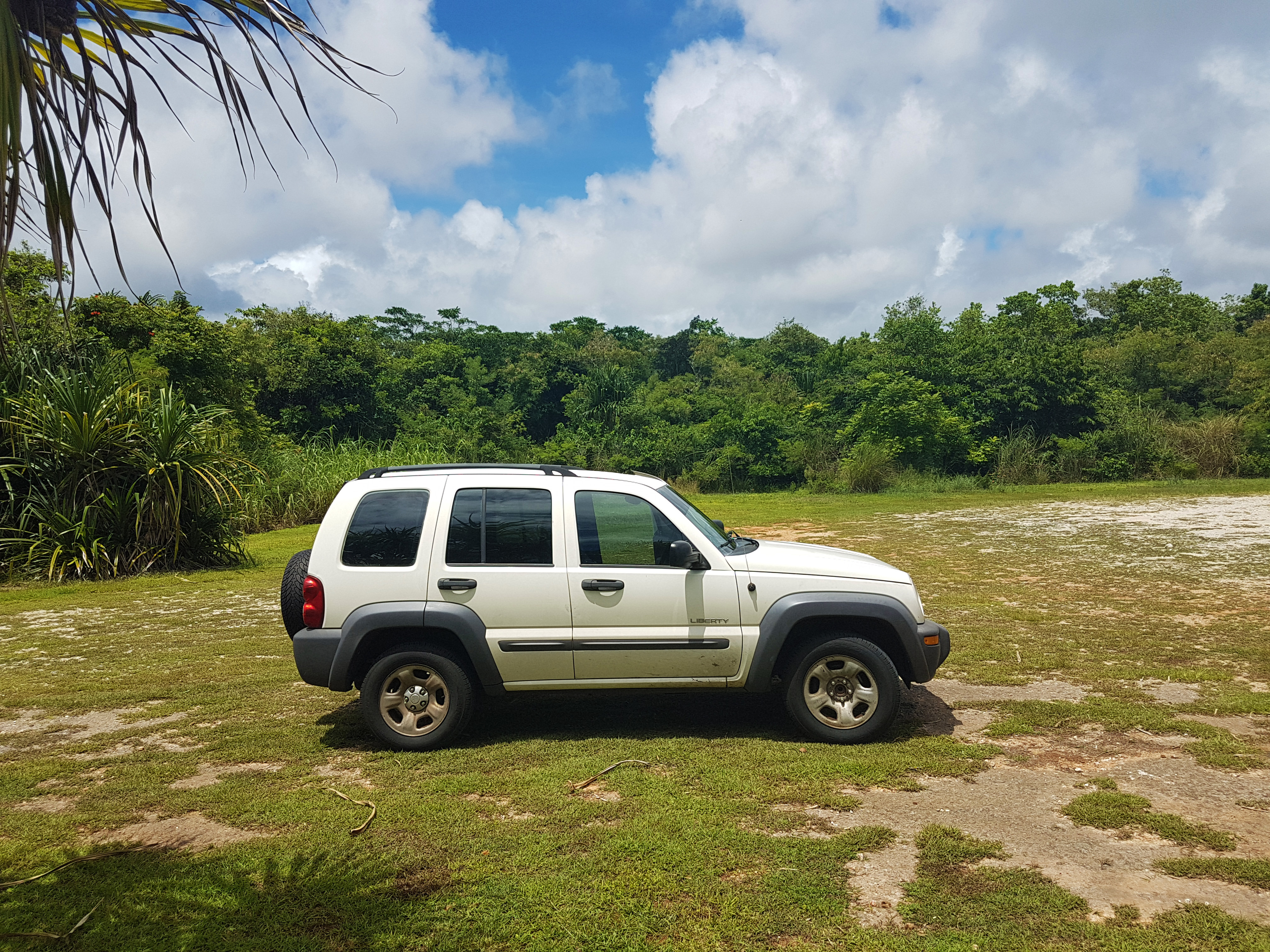
If you are just coming to Guam, I cannot recommend a Jeep or truck to you enough. Don’t buy anything nice that you will love, because it will get scratched up and end up covered in rust from the salt and the sand. Get an old beater that you can fix up a little and take everywhere.
We got a Jeep Liberty which we bought cheaply because it needed work. We ordered all the parts through Rock Auto and had them delivered, and it’s been a good vehicle for the island. We’ll be selling it soon, and it will be hard to part with. It’s a good car, and now that we replaced all the parts in the suspension, it’s even a smooth ride.
Anyway, if you are visiting: rent a truck. If you are moving here: buy a truck. Most of the best spots on Guam are very dangerous to take a car to.