I move in less than a month. It’s also our anniversary month, and my birth month. So, there is a lot going on. Rich and I are not looking forward to living apart for six months while he goes to school and I set up a home for us in Hawaii, but that’s just part of the military life, so we’ll make it work.
The Wooden Show Tulip Festival on a trip back to Oregon from Guam.
I have really enjoyed everything we have done here on Guam.
I loved the work I did to help the animal shelter here (called Guam Animals in Need.) I loved the volunteering I did with NOAA to help monitor the reef, and to donate photos for promotional materials. I loved the friends I made and the reefs I snorkeled. And, when I was working, I loved Sea Grill and Pika’s.
At the coast on a recent trip back to the states.
Now, it’s time to look forward.
I guess we won’t be able to be as eager for visitors in Oahu as we were in Guam. We had more space in Guam, and I had time to show people around. I am afraid those are luxuries we won’t enjoy in Hawaii.
We’ll do our best, of course. But I think if you visit us in Hawaii you’ll need to get a hotel near by and see us on the weekend. Different island; different life.
At GAIN helping a puppy calm down after surgery.
I’m nervous to look for a job on Oahu. I’ve heard that the wages are low and the cost of living is high. If there’s anyone you know or any professional connection you have that could help me, please don’t hesitate to get in touch. My email is still jenifer.delemont@gmail.com.
On a trip to Maui where I went on a black sand beach tour.
Oahu offers all new hikes and all new reefs. I am looking forward to that. Guam has been lovely, but it is very hot and tropical here. The cool breezes of Oahu will seem like a dream come true!
I am sure I will spend a lot of happy weekends under water and out on hiking trails, which is something I am really looking forward to.
Last summer we went to the family reunion and then visited the glacier on top of Mt. Hood.
I guess what I am trying to say is: the future looks bright.
I may not update this blog for awhile because I’ll be busy with house-hunting and job-hunting. However, I adore you all very much, and I promise to tell you all about my new home once we settle in.
I am now selling select photos on Shutterstock. I would be amazing if you could spread the word. You can also always check out my YouTube Channel. A lot of my under water adventures are on there.
Since I have been volunteering at NOAA doing reef monitoring, I spend a lot of time in the water. As long as I am on the reef swimming anyway, I may as well snap some pictures for myself, right? So here are some of my favorites. I hope you enjoy them!
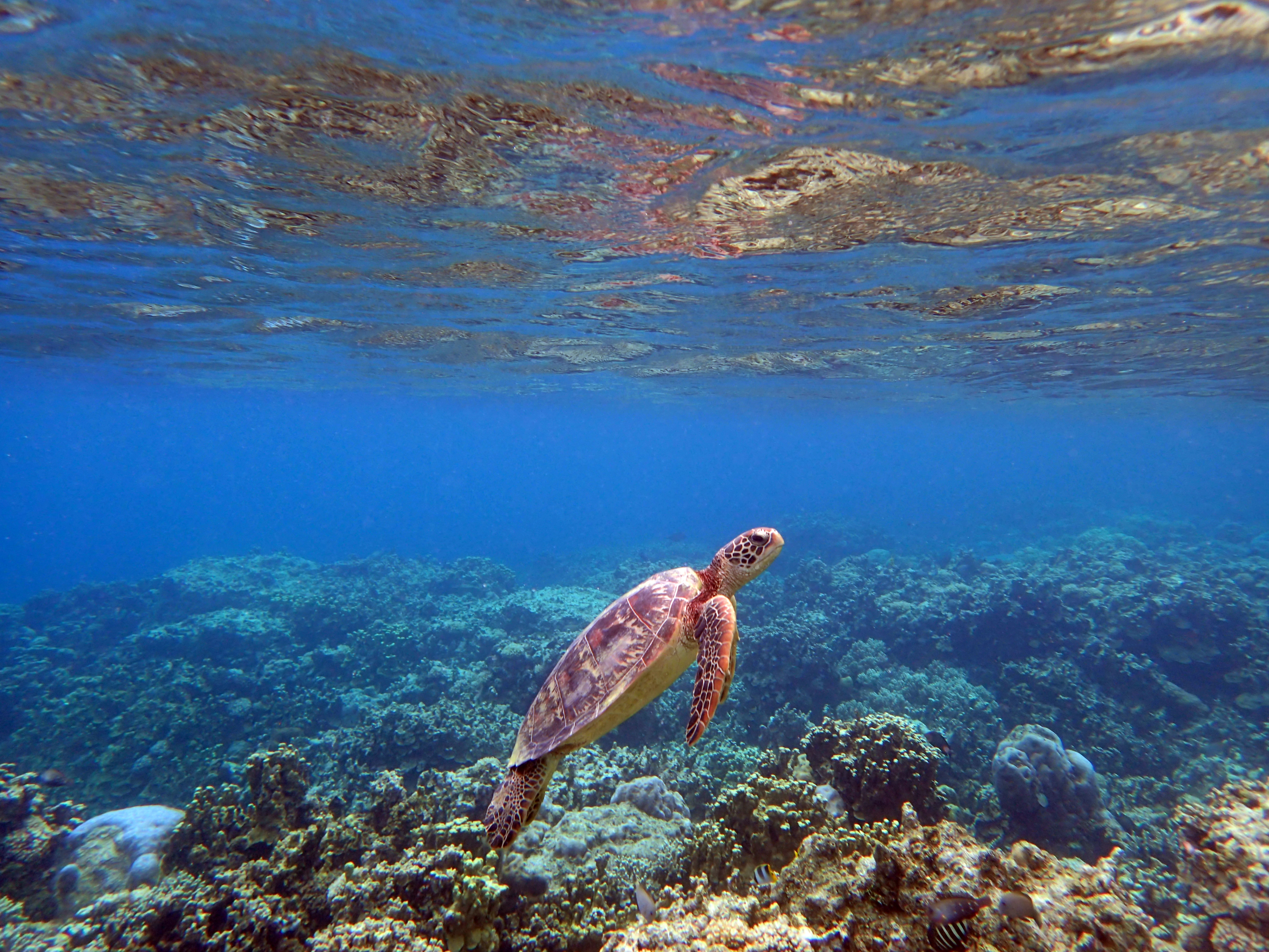
Green sea turtle diving.
Hawksbill Sea Turtle
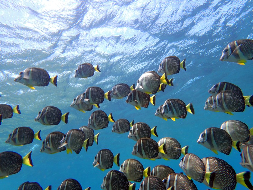
Convict Surgeon Fish Schooling
Green Sea Turtle breathing
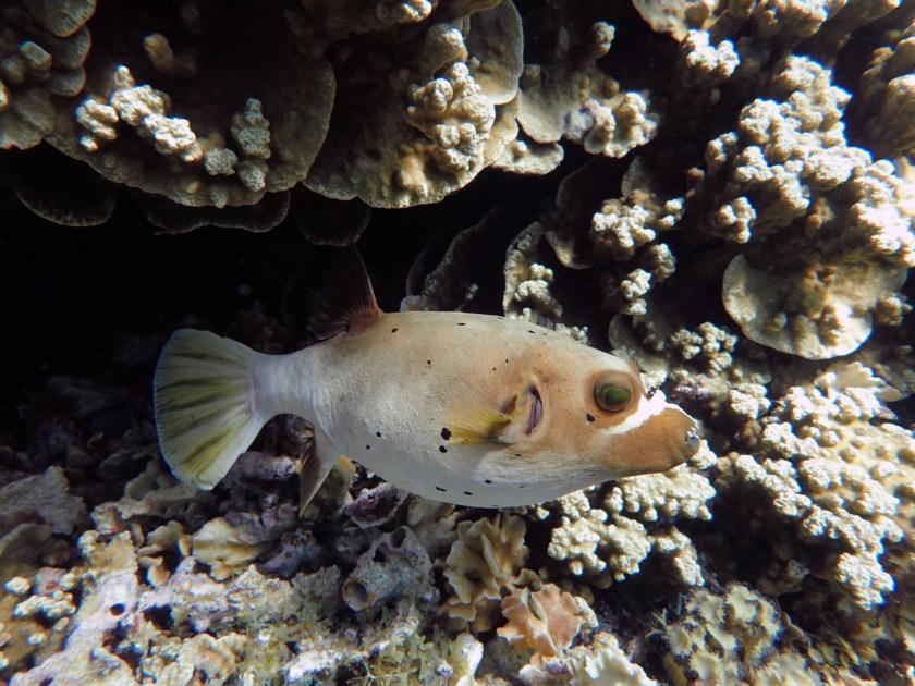
Masked Puffer
My husband Rich having a closer look at a Hawksbill
An octopus hiding in a rock
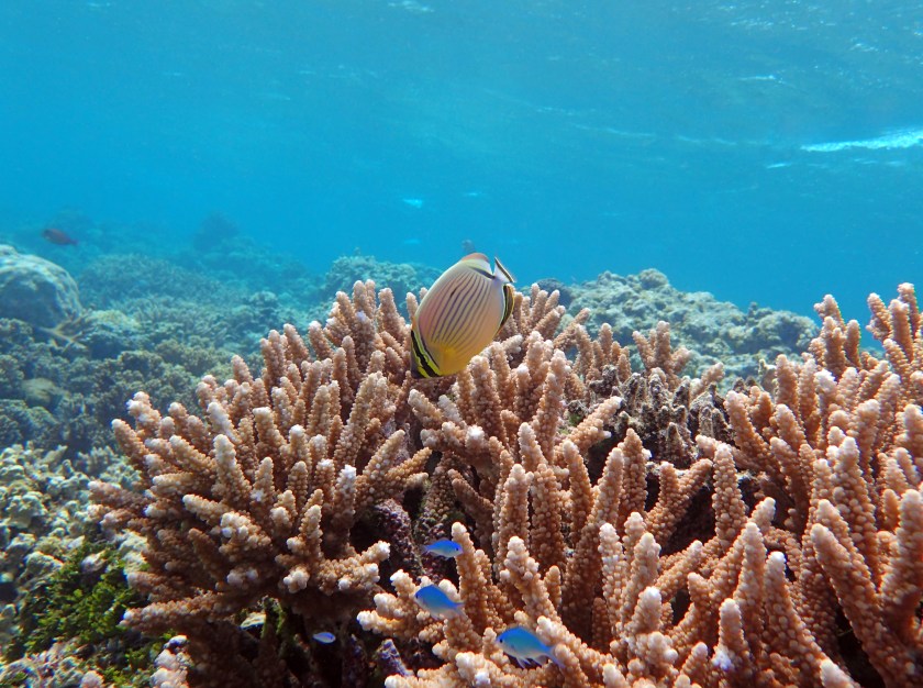
Oval Butterfly Fish over stag coral
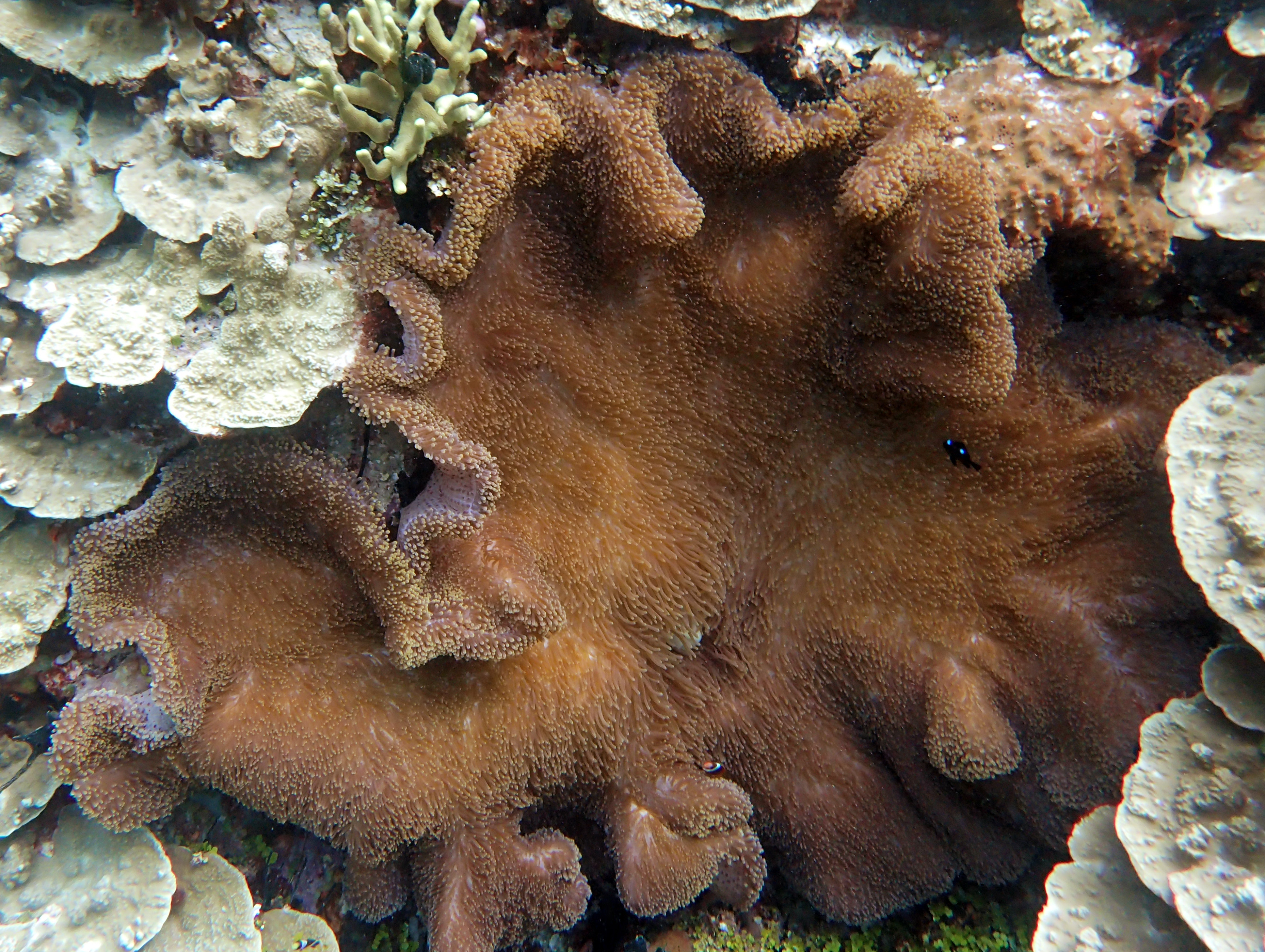
Just a Bit of Reef
Octopus!
I don’t take a lot of pictures on land anymore. I am sure that will change in Oahu. It’ll be cooler, so hiking won’t be as unpleasant.
This is just a post full of pictures from around the island.
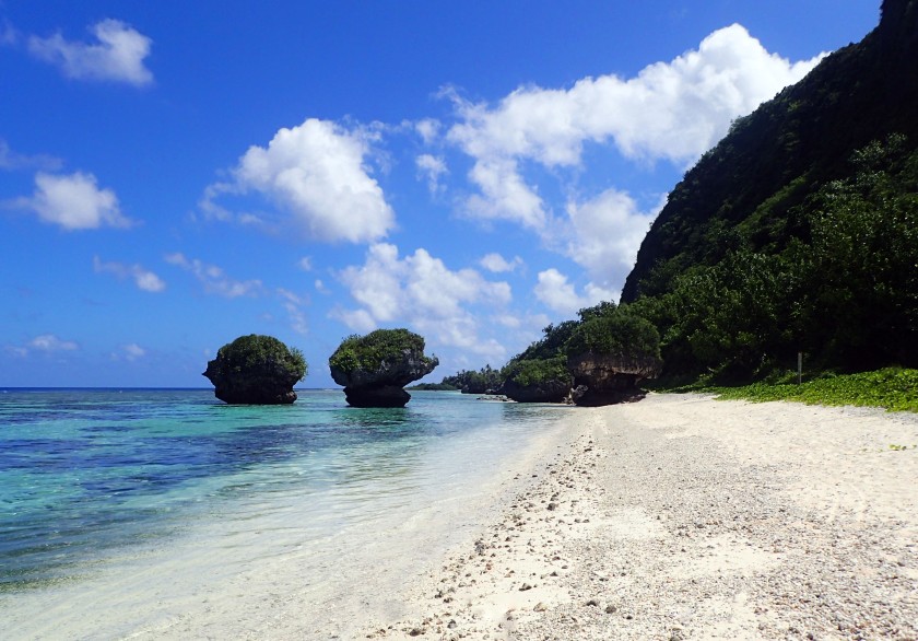
A rope swing a San Luis Beach which you can only get to at low tide.These trees are covered with flowers every springMe in downtown TumonTumon Bay, where I live on GuamA single plumaria flowerSunset over the oceanFlowers on an orchid tree (one of my favorites!)Clouds reflecting on the surface of a pond by the portGab Gab marinaJust a dreamy sunset
There are several popular places for tourists to go on Guam. One of them is Two Lover’s Point. As many of you probably know, Guam was invaded by Spain in 1565, and the peaceful Chamorro people who lived on the island were subject to a fairly brutal rule by Spanish conquerors.
During the time of the Spanish occupation of Guam, a ship’s captain took a fancy to a pretty island girl. Unfortunately, this girl was in love with a island boy. When it became clear that she would be married to the Spanish captain against her will, she and her lover jumped off the point together. They felt they would rather die together than live apart.
This brutal story is an odd inspiration for a tourist destination. However, the Japanese and Korean tourists that frequent Guam find it romantic. In fact, many tourists have been married at Two Lover’s Point. Others go to place “love locks” there to declare their undying love for each other.
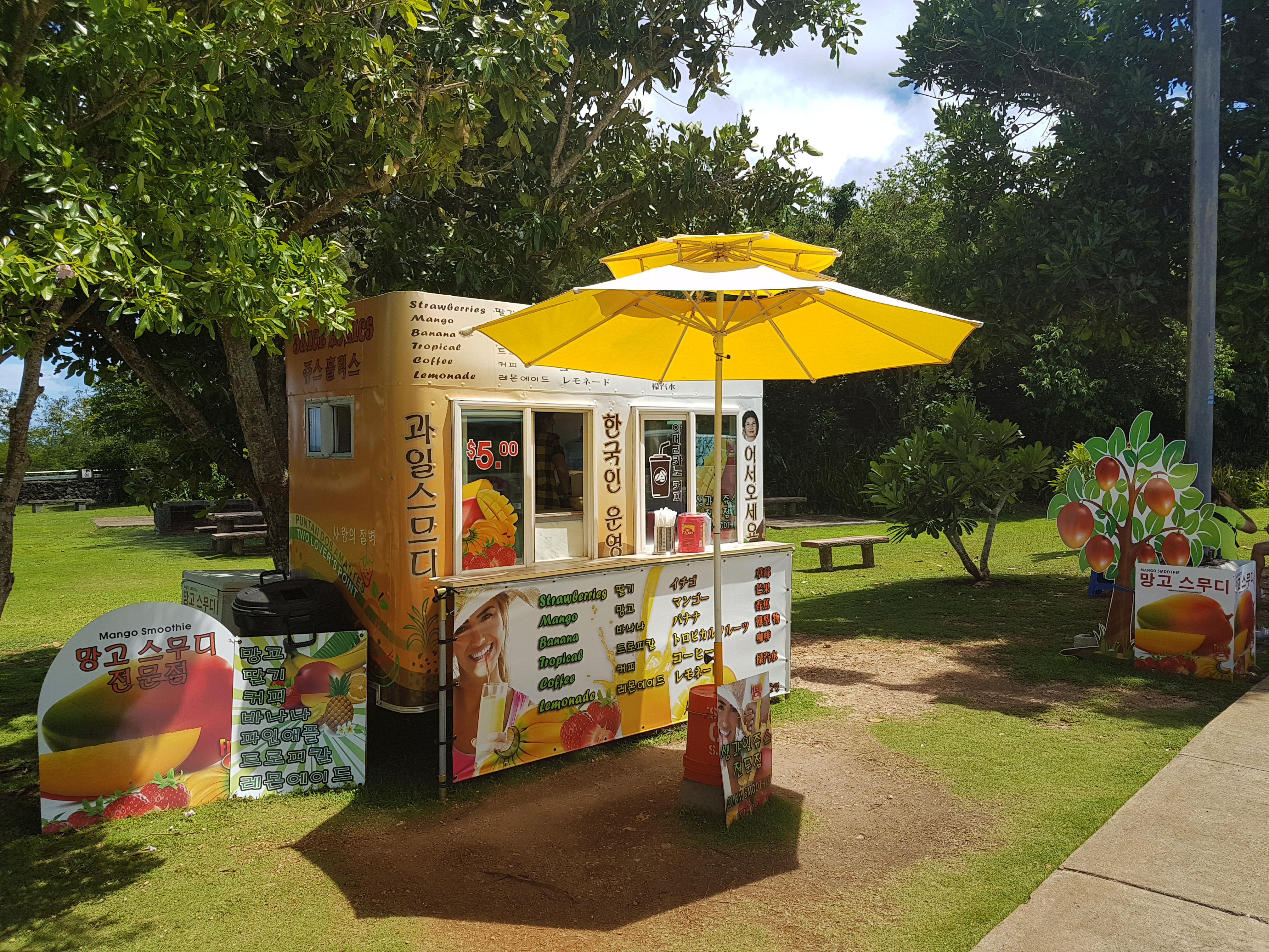
A fruit stand which brags that it is Korean-owned and operated.
Before I lived in Guam, I spent a little over three years living in South Korea. During that time, I learned to read and write Hangul, which is the Korean written language. That is why I can tell you that this fruit stand is advertising Mango Smoothies, and also the fact that they are Korean people. I assume that is so that the Korean tourists will buy from them instead of from other shops at the point.
In South Korea, I was impressed to find that all the fruit juices were made from real fruit that was blended with ice to make a drink. I had hoped that this stand would be the same, but fresh fruits and vegetables are hard to get on this island. It is made of coral rather than being a volcanic island, and so the soil is not very fertile. As such, all the smoothies are a disappointing blend of ice and flavoring powder.
I hope some day Guam will start to utilize the new technologies available to farm in a sustainable way. Actually, everyone should be doing this since soil nutrient levels have become dangerously low.
Two carabao statues at Two Lover’s Point.
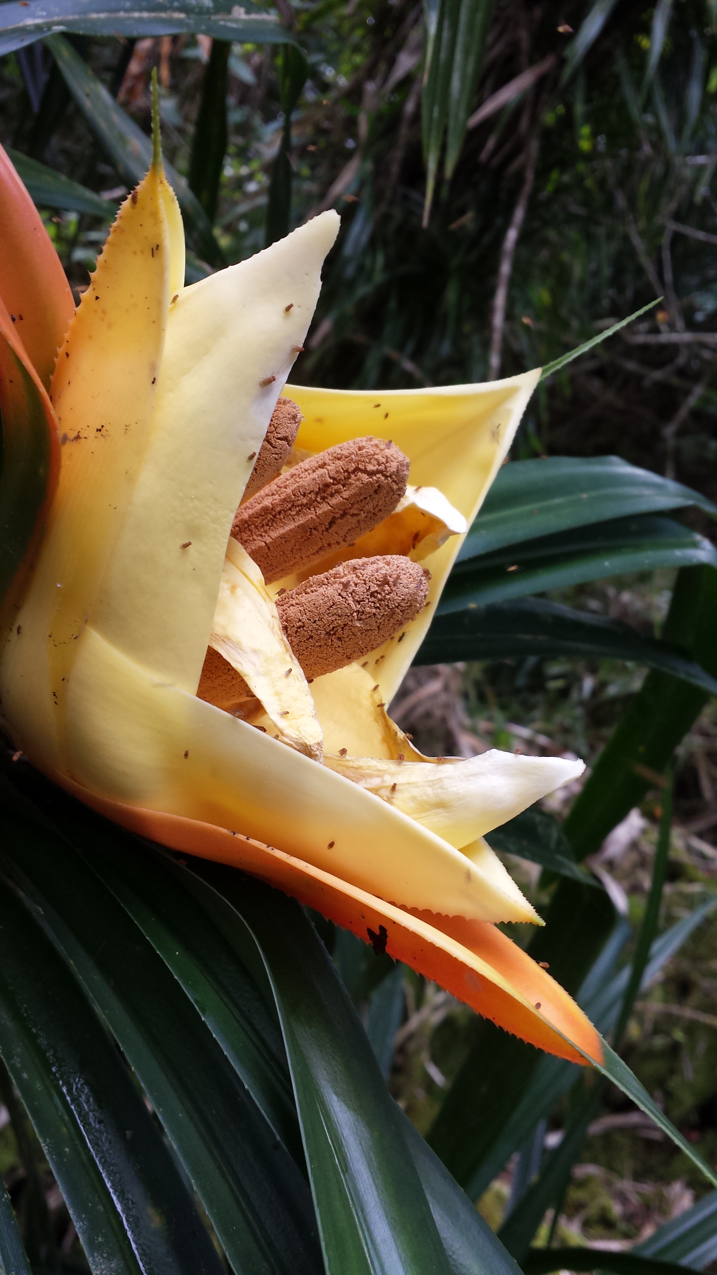
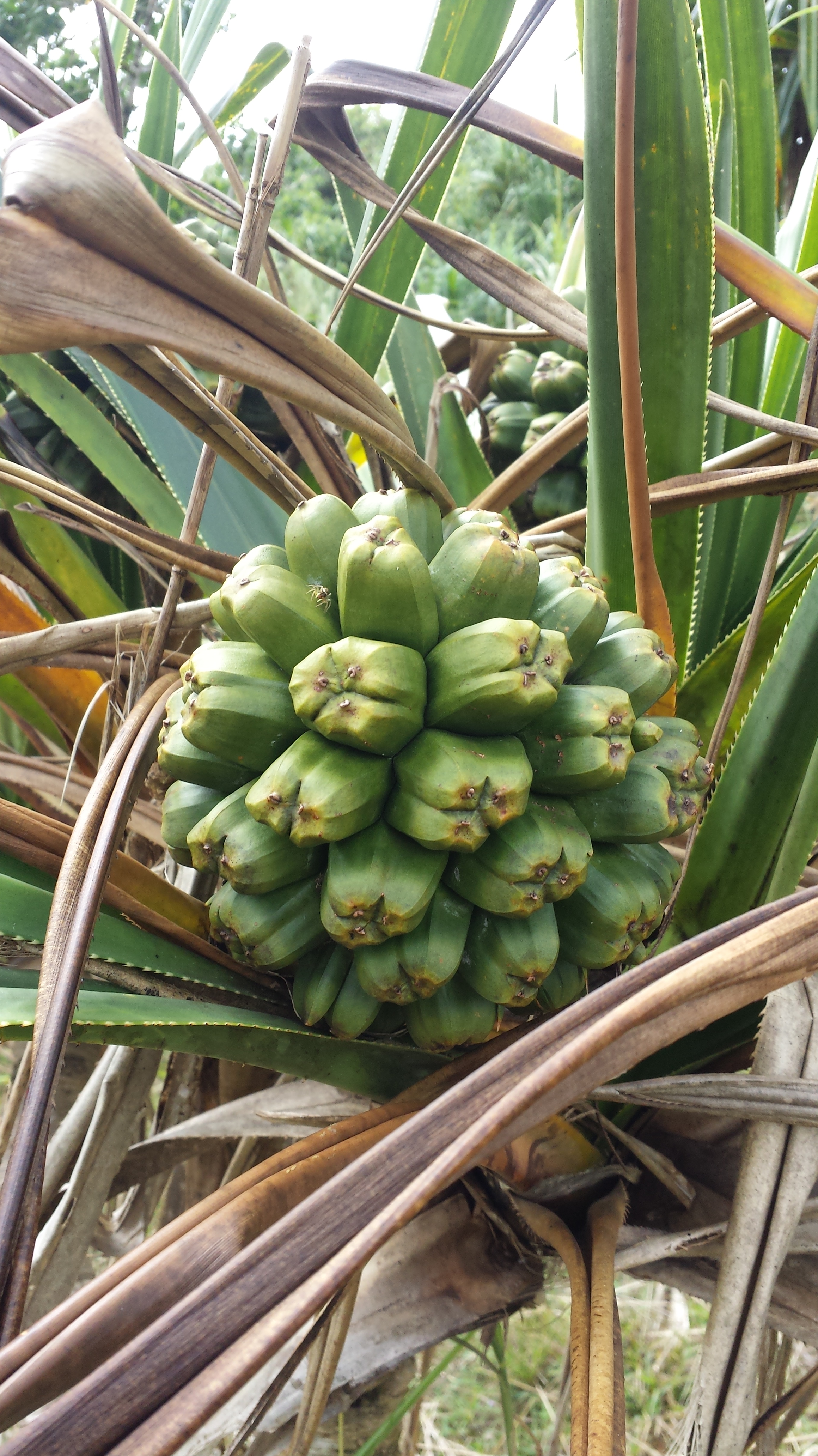
The statue here is of two Carabao. A caraboa is an Asian Oxen which was brought to Guam by the very first settlers, the Chamorro people. They are not indigenous, since that title is reserved for animals who evolved on the island. However, they have been on Guam so long that they are considered to be indigenous in the eyes of the locals.
Guam has actually been fighting to get rid of brown tree snakes, toads, rats and other invasive species. However, it is very hard to eliminate a population of animals once they have been introduced. New Zealand wants to try a new gene editing technology, but that is fairly terrifying since containing genetically modified animals is impossible.
Whatever the solution, the caraboa has a safe place on Guam and is seen as part of the cultural heritage of the people. You can find statues of them all over the island.
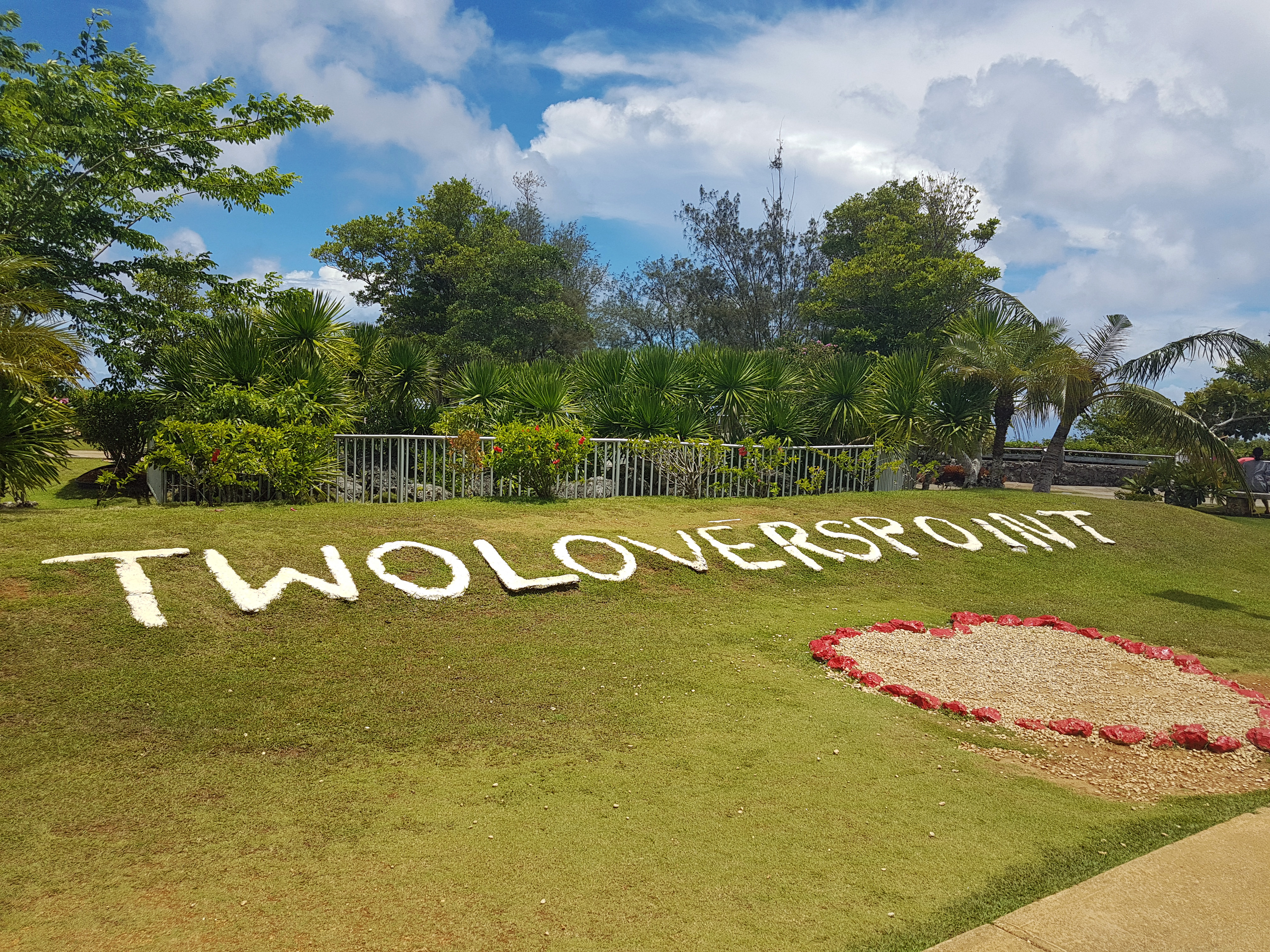
Love Locks and hearts at Two Lover’s Point.
These are the love locks I mentioned earlier. This tradition of putting love locks in various places it common in many countries across the world. It seems to me that they are always in places like Two Lover’s Point, where there is a little bit of sadness to the location.
Take, for example, the town of Lovelock Nevada. This tiny town is in the middle of the Nevada desert, and really only exists to sustain the strip mine and the prison. The majority of people who travel to Lovelock Nevada are there to see a relative or loved one who is in the prison.
Rather than couples leaving rocks with two sets of handwriting, it is mostly mothers and wives leaving love locks in Nevada, in hopes that they will see their loved ones again some day.
I don’t know how I feel about this tradition, but my husband and I didn’t put our names on a heart and lock it to the point. It seemed morbid somehow, and like it would be a bad omen for our marriage.
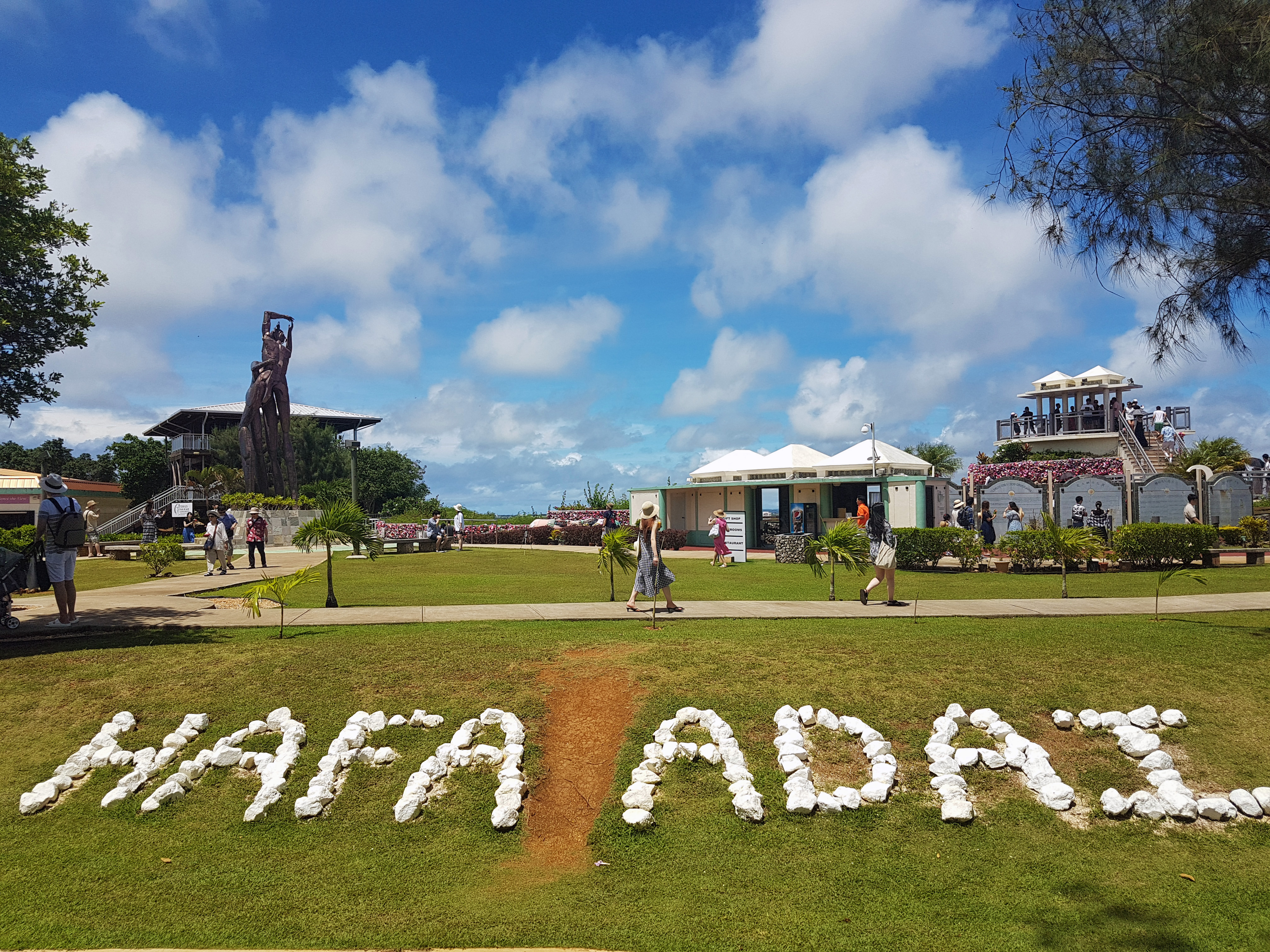
Two Lover’s Point sign.
The main reason to go to Two Lover’s Point is for the views. There are several places that are intended to be good photo spots, such as the Two Lovers Point sign (above) and the sign reading “Hafa Adai,” which means “hello” in the local language.
There are a lot of good photo opportunities that are free of charge, and if you do them all, you will have a pretty good album to show off. However, the highest point is behind a pay wall, and you will need to give $5 (or $2 with Guam ID) to the gatekeeper if you want to see that view.
In case you don’t want to spend the money, I have included a picture (later in this post) of what it looks like. You can actually see my house in the picture if you look real close! (We spent the last several years in a building in Tumon Bay called Blue Lagoon.)
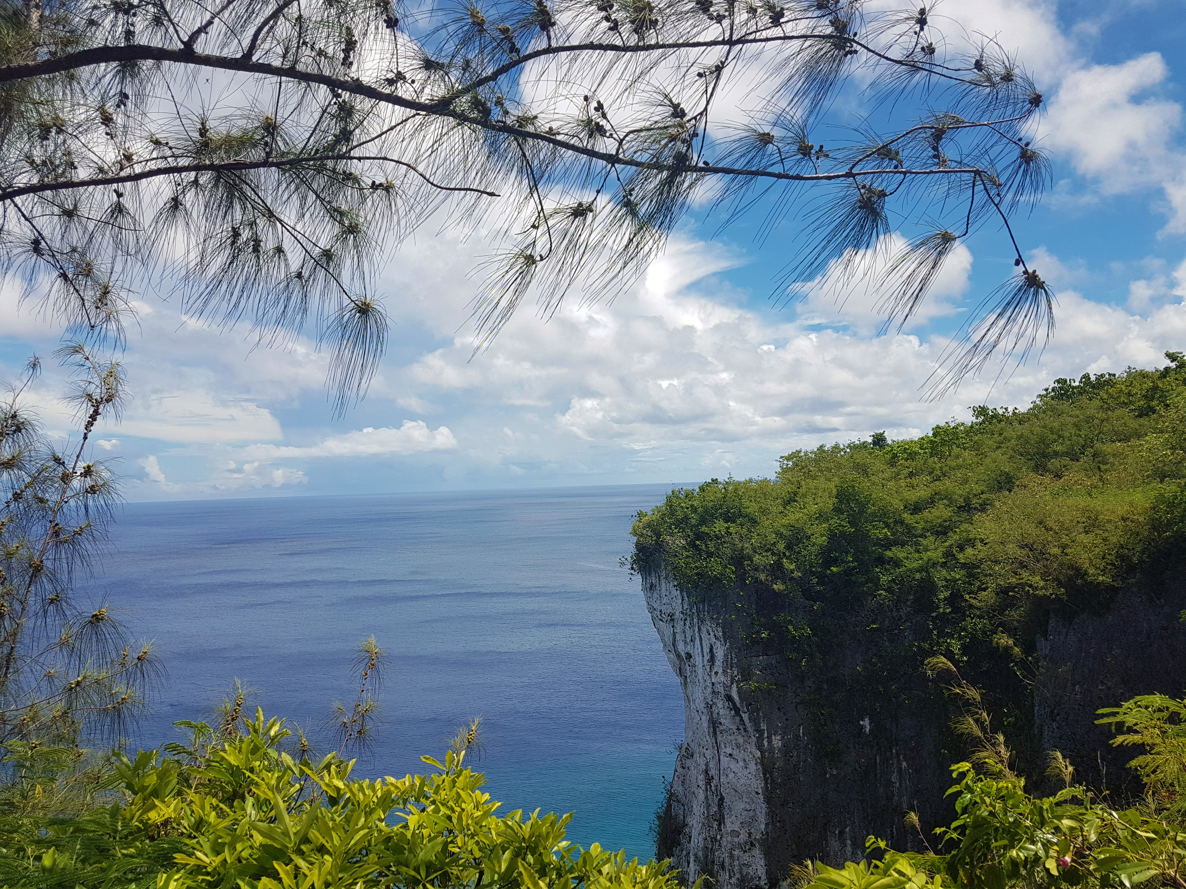
Looking out at some of the cliffs.
If you are already going to Two Lover’s Point, you may as well check out Tanguissen Beach as well. However, I should warn you that it is not something to do in just any car. It is best if you can get a truck or a Jeep, because the road is dangerous and at the bottom, there is quite a bit of driving on dirt.
The turn for Two Lover’s Point off Marine Corpse Drive is marked, and you can easily see the sign. It’s almost directly across the street from Micronesia Mall. You turn, and go down a long road through the jungle. However, there is a second turn that you must make to get to Two Lover’s Point. It’s a left, and there is a HUGE sign to let you know to turn.
In order to get to Tanguissen, just follow that road straight instead of making the right-hand turn. Slow down to about 10 MPR because there is a fair amount of traffic that comes around the blind corners a little too fast, and the potholes seem to jump out of nowhere (and those potholes could shollow up a Smart Car.)
Free view of Tumon Bay.
You follow the road until you get to the bottom of the hill. There, you have two choices: You can turn left and continue along some pavement to a power plant, or you can leave the pavement and go straight.
The power plant has been recently retired by the Guam Power Authority, but it is still closed to the public and not safe to explore. It is also not recommended that you swim in the spillway coming from the plant, which no longer dumps hot water into the ocean, but which has dangerous currents and sharp rocks around it.
I like to take pictures around the plant because I think it looks neat, but I have never gotten in the water there.
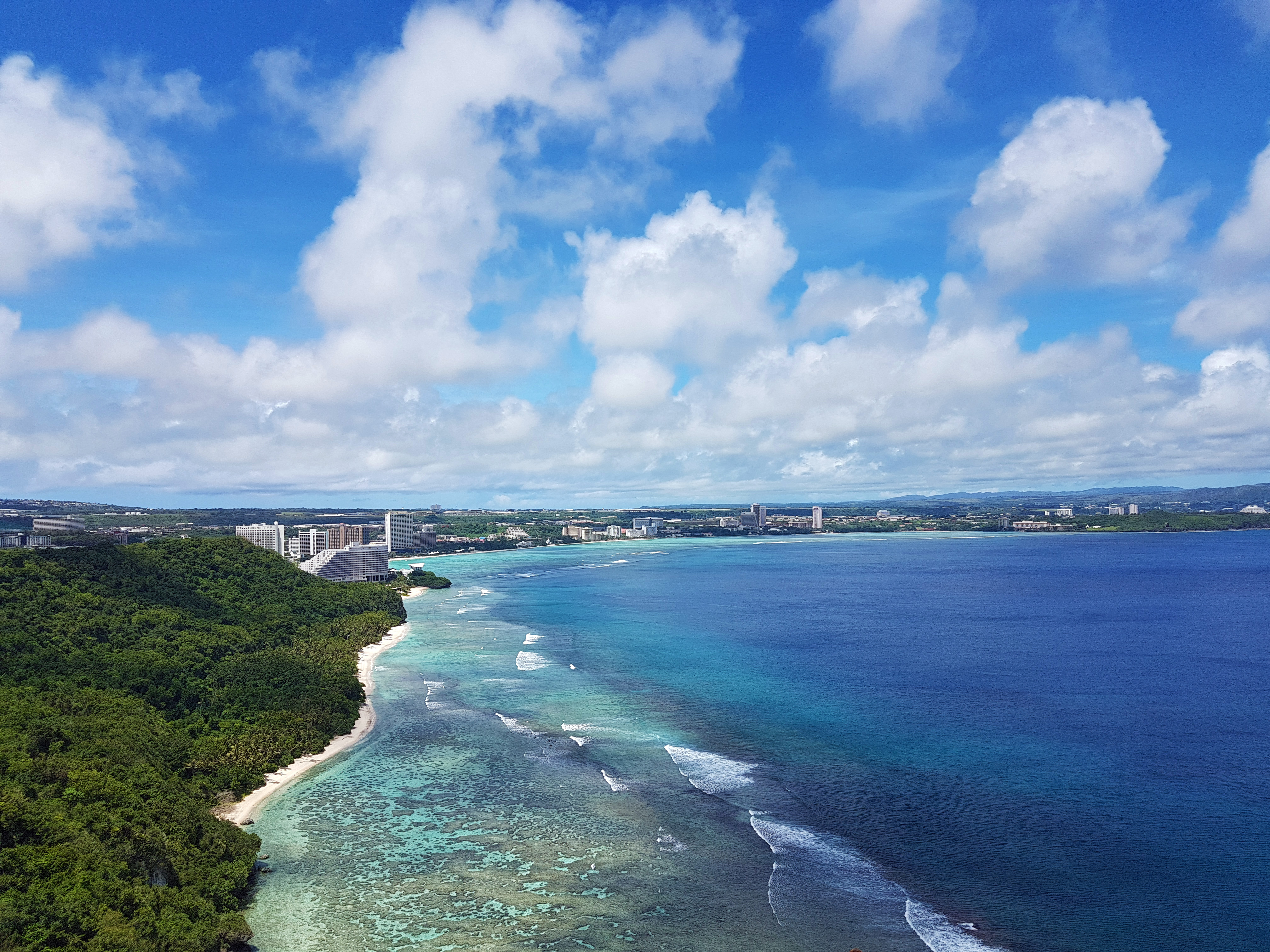
Tumon Bay paid view from the overlook point.
However, there is a great place to go swimming- it’s just a little tricky. See, the beaches here on Guam are all public property. You cannot actually own a beach. However, you can own the land that a beach is attached to. Tanguissen itself is public, but it is not a good place to swim. However, it is attached to a beach that is nice for swimming, and that beach is attached to private property.
What you do is this: To the right of the beach is a small path along the water. It looks dangerous and like it doesn’t go anywhere, but it does. Just follow that path through the rocks. Make sure you have coral shoes or some other kind of sturdy water shoe.
You’ll come out of the jungle and see a long beach in front of you. If it is high tide, some of your walk will need to be through the water. Do not swim as soon as you get out of the jungle. The water is shallow there and full of very sharp rocks. Just keep walking.
Tanguissen Beach and abandoned power plant.
As you walk along the beach, you may want to pick up sea glass. This is a good place to find it, and people tend to use sea glass in all kinds of art projects. There are sometimes shells on the beach as well, but remember: most shells on Guam have animals living in them! Hermit crabs are everywhere on Guam, and it’s best to leave the shells for them.
Tanguissen used to have some beautiful stag corals, but they bleached in 2017 and have not grown back. Now, it is mostly algae. However, it is also a good place to see sea urchins and puffer fish.
Fins are not recommended at all if you swim. The water it too shallow and it is best to float while keeping your feet on the ground and walking. This way you will not bump into any of the coral and damage it.
A walk along the beach.
Of course, most people don’t go to Tanguissen to swim; they go for the rocks. The rocks at Tanguissen were once part of the imposing cliffs the line the beach. However, they broke off and fell into the water. They have been eroded by the ocean and watered by the rain, and they have become quite beautiful.
Please remember that if you plan to climb onto turtle rock (the one with a shelf for standing on) that you should walk out in coral shoes, and try to avoid stepping on the coral. Keep your eyes on the ground and move carefully. There are tiny clumbs of coral here and there which are home to many fish, and they will not thank you for stepping on them.
Climbing on the rocks is (of course) not recommended. You won’t have cell service there and emergency services couldn’t reach you anyway, so if you hurt yourself you will still have to walk back to your car. In other words: maybe just take a picture of you standing in front of them?
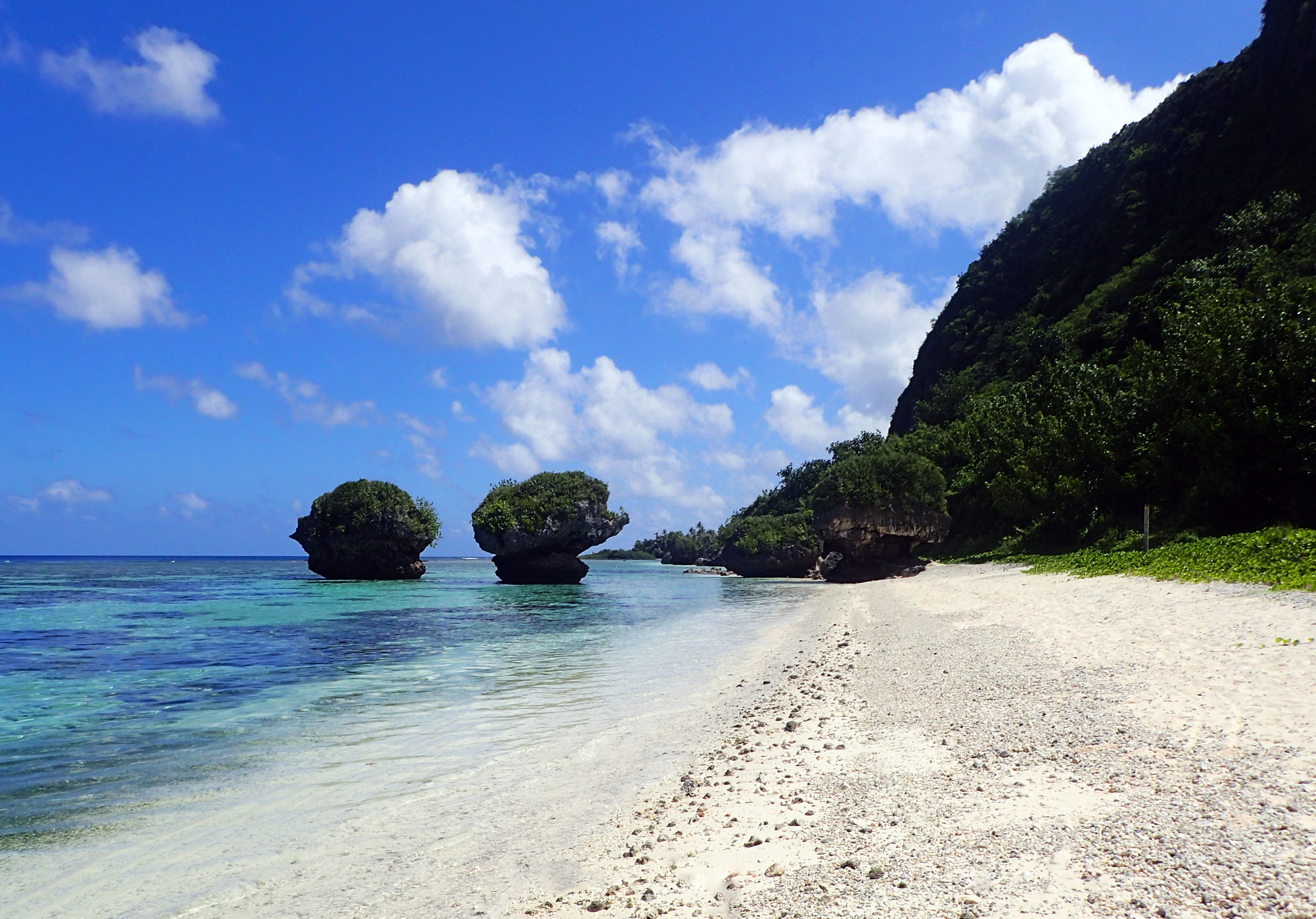
Turtle Rock
You can walk past the rocks and follow a path up into the trees that will take you to one more tiny beach, but it’s not really safe to swim there, as there are more sharp rocks. Tanguissen is actually off-limits to the military because it has so many dangerous spots, but you can frequently see a tourist of two swimming there.
As with most spots on Guam, people sometimes die there. The island doesn’t have much in the way of safety nets or guard rails, so you need to use common sense when going places and always be aware of the fact that the coral and the rocks are sharp and will cut you open.
If you swim, stay inside the reef and away from the coral, and you should be okay. It is a wonderful chance to see baby fish who come and hide in the shallow water from sharks and other predators.
Another view of the rocks.
Also keep in mind that you really shouldn’t go up onto the land. It is owned by a local who is sometimes there on weekends. If he is, he may invite you to come up and say hello. Otherwise, remember that it is private property and be respectful of that.
As long as you are careful and respectful, Tanguissen is a wonderful place to get some breath-taking pictures and to spend a relaxing evening enjoying the sun and the sand. It is best to go after noon, as the cliffs cause the area to be in shadow in the mornings (making it impossible to get good pictures.)
A lovely lawn to sit on.
If you are just coming to Guam, I cannot recommend a Jeep or truck to you enough. Don’t buy anything nice that you will love, because it will get scratched up and end up covered in rust from the salt and the sand. Get an old beater that you can fix up a little and take everywhere.
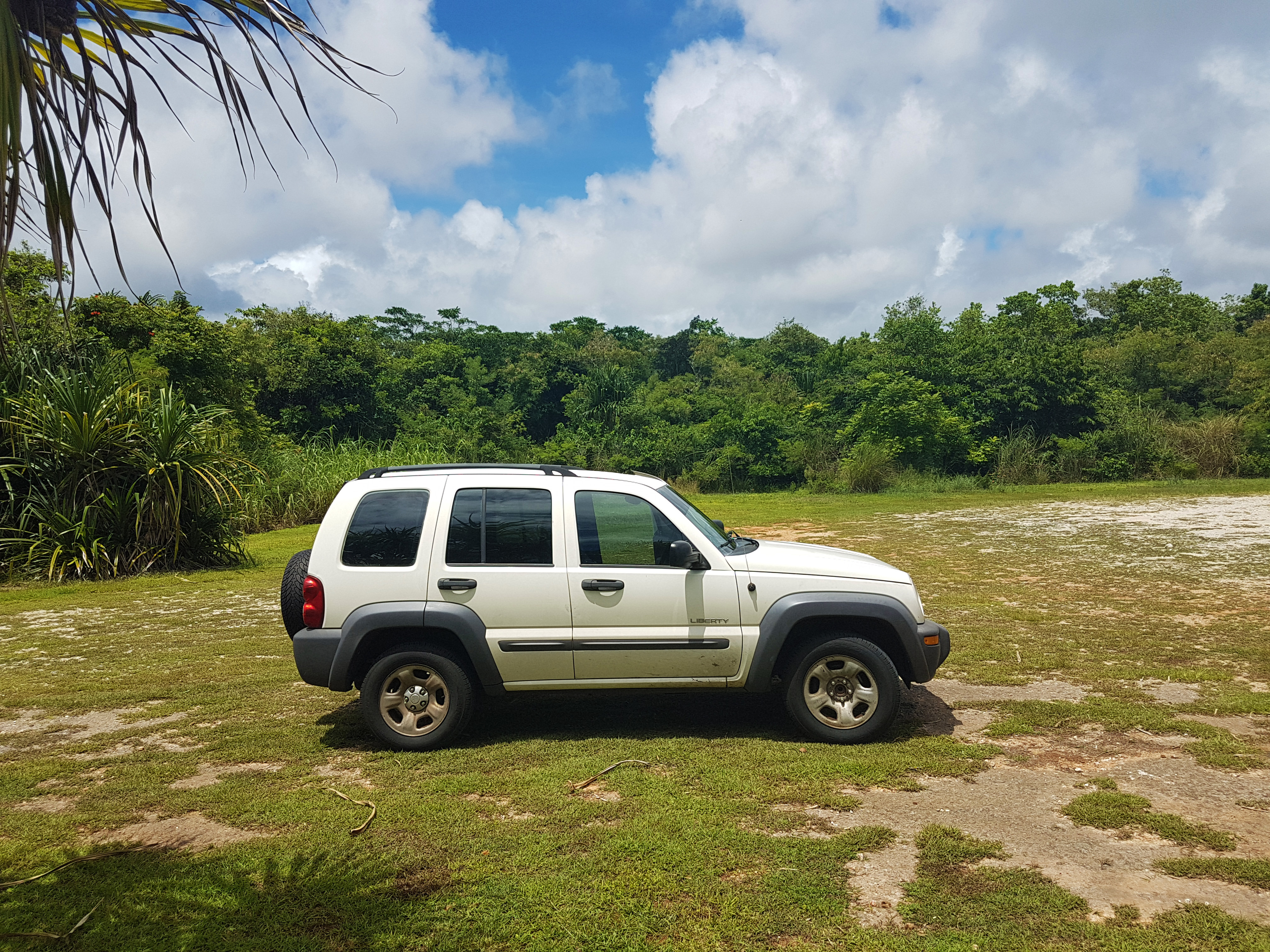
We got a Jeep Liberty which we bought cheaply because it needed work. We ordered all the parts through Rock Auto and had them delivered, and it’s been a good vehicle for the island. We’ll be selling it soon, and it will be hard to part with. It’s a good car, and now that we replaced all the parts in the suspension, it’s even a smooth ride.
Anyway, if you are visiting: rent a truck. If you are moving here: buy a truck. Most of the best spots on Guam are very dangerous to take a car to.
If any of you snorkel or dive, remember that you can always share your data with a reef monitoring project and help advance science.
I want to talk to you today about how to take pictures for reef monitoring, how to label and make notes on those pictures, and where to send them to. Hopefully some of you will find this interesting, and you’ll want to spend some time helping our oceans!
If you plan to do so, there are a few things that you want to remember:
Overall shots of the reef are more important than close-up pictures of fish or coral. The main thing that NOAA is doing is monitoring overall coral health and counting various animals/corals. For this, wide shots are best.
Make notes on the depth the photos were taken at, and of anything else that may be relevant. Remember to think like a marine biologist and note things like: The number of animals sighted and if it is higher/lower than normal, the amount of litter, any invasive species such as the Crown of Thorns, and an estimate of the water temperature. All details matter because they put the data in context (data out of context is less useful.)
Crown of Thorns
You’ll want to submit the data on a flash drive with your name and contact details, and make sure to say whether or not you want credit by name if they use a photo you took for something.
Find the local NOAA office in your area and go in person, or mail the flash drive in. If you cannot find a local office, you can always do a Google search for reef monitoring in your area.
Example: I live on Guam, which is part of the Marianas Islands. So if you type in Marianas Island Reef Monitoring, you get Eyes of The Reef (which is our local outreach program by NOAA.)
If you are in the Hawaiian Islands, The Marianas Islands, or anywhere that there is coral, you should think about sending your pictures to a reef monitoring project. Even if you only go on vacation to one of these places, remember that science is about the aggregation of data and looking for patterns, and more data is always better than less.
I have been helping to share data with the Eyes of the Reef project that NOAA has in Guam for years. It’s just a drop in the bucket when you look at how big the reefs are and how many reefs there are, but every little bit helps.
It’s unfortunate that rays are such a rare sight on Guam. My husband and I have been snorkeling nearly every weekend that we have lived here, but we never say one.
Yesterday, we finally saw one for the first time ever and it was glorious. It went gliding along the ocean floor in front of us and it was beautiful. It’s hard to tell scale under water, but it was big. I would guess about four or five feet across; maybe a little more.
If it helps for scale, we were snorkeling on the surface of the water about 30 feet from the ocean floor. Anyway, it was a magical experience and I am really glad that we got to have it before we moved to Hawaii.
One more of the Manta Ray.
If you check out my YouTube Channel, you can find a lot of the other amazing sea life that we have seen here on Guam.
We have come across a lot of stunning things, from turtles to cowrie shells, and even a friendly barracuda. It has been a real adventure living here, and I’ll miss it when we go.
Tangussion: Snorkeling in Shallow water; no diving. Access: Everyone.
Out past Two Lover’s Point down a thoroughly sketchy road, you will find Tanguisson Beach. It is the site of an old power plant. Now that the plant is shut down, you can go swimming in the area where the hot water used to come out. You can even see some fish there. However, people mostly go to Tanguisson to sit on the beach. The sand is white, the water is blue, and everything is beautiful.
If you look to the right side, you will see a path hidden at the edge of a cove. Following this path takes you to the second part of Tanguisson. This has some iconic rocks that people usually take really stunning pictures with.
Second Beach at Tanguisson
The water is shallow at Tanguisson, but you can swim there. Once upon a time in 2016, it used to be a place where you could see hundreds of sea urchins. However, an explosion in the puffer fish population happened in the spring of 2017, and the puffer fish ate all the sea urchins.
Much of the coral bleached in the big bleaching events in the summer of 2015 and 2017. However, there are still some fish and corals living there. The key thing to remember is to not go past the reef. This is an area that is known for dangerous tides, sharp rocks, and no lifeguards. If you go on a weekday, you will likely be the only one there. If you are swept out to sea, no one will know.
Given that, I recommend that you go swim in the shallows. Look at the fish, take pictures with the rocks, and lounge on the empty beach. Collect sea glass, which is often found there. Have a picnic. But don’t go beyond the reef.
Tanguisson Under Water
Gab Gab: Snorkeling or Diving in Deep Water.
Access: Restricted.
If you are looking for some deeper water, Gab Gab Beach is one of the best places to go. It has easy water access because of the stairs, and it even has showers. This is a very popular place for both snorkeling and scuba diving.
However, Gab Gab is on the Navy Base. That means that if you don’t have a military ID, you need to find someone who does in order to go there. This is kind of a bummer if you are a tourist, or a local with no military ID.
On the upside, if you can go there, you will find it less crowded than other places because access is restricted.
Gab Gab Entry Point
I like to go to Gab Gab because it is easy to get into the water. There is no long wade or swim to get out to the reef. And, the water is calm because it is inside of a harbor and is therefore protected from currents and tides that might otherwise prove problematic.
I also like to go to Gab Gab because it is a brilliant place to see turtles. They tend to enjoy spending time in some of the more shallow areas where they can bask in the sun. They also swim over to the boats at the port, and eat algae off the sides. Any day that I go snorkel or dive and see a turtle is a good day in my book. They really are magical.
Gab Gab was effected by the bleaching event in the summer of 2017, and some of the corals in the more shallow areas died. However, the deeper reef is still intact and as beautiful as ever.
Gab Gab Under Water
Gun Beach: Snorkeling or diving in deep water. Access: Everyone.
Another fabulous place to snorkel or dive is Gun Beach. A quick word of warning: About every six months, someone dies at Gun Beach. Therefore, I need you to listen up to the warning I am about to give you:
This is a reef that is not enclosed in any way. There are waves, currents, and tides. If you see white caps when you look out, do not get in the water. Just hop back in your car and go to a different spot for the day.
The people who die at Gun Beach are usually scuba divers who go out too far, and then get caught in a current and pulled out to sea. They only find the bodies about half the time. Please don’t leave the safety of the reef, and do not go out when the water is choppy.
Gun Beach
Most of the time, the water is smooth as glass and it is perfectly safe to snorkel or dive at Gun Beach. You park out by the Beach Bar, and then walk out to the water. Look for the pipes, and follow them out to the reef.
The water is colder than anywhere else on the island. If you are used to Hawaii water temperatures or colder, you will be fine. However, if you are used to the tropics, I recommend wearing a rash guard and pants.
The reef is beautiful. There are so many kinds of corals and fish! A lot of times you see bigger things too, like giant porcupine puffers, octopus, and huge schools of trigger fish. This is easily one of my favorite places to snorkel, and the swim out really isn’t that bad. I would note that the swim out is much easier at high tide, so keep that in mind. However, you can really make it out at any time of day.
As long as you do it on a calm day, Gun Beach is amazing. I highly recommend it.
Gun Beach Under Water
The Spanish Steps: Snorkel in Shallow Water; no Diving. Access: Restricted.
The Spanish Steps is another one of the beaches with restricted access. Like Gab Gab, it is on Navel Base Guam. Unlike Gab Gab, there is no easy access to this snorkel spot. You will have to hike in, and the trail is steep and dangerous.
If you go, I recommend hiking boots, long pants, and climbing gloves for the parts so steep that you have to use the ropes provided. It’s not a long high, but it is a very intense high. I wouldn’t bring small children or anyone with any major physical limitations.
However, if you can make the hike, this tiny pocket of life is really very pretty. Obviously you can’t dive there, but the snorkeling is awesome!
Spanish Steps Beach
The Spanish Steps are at the very end of Orote Point. You can’t go out into the open water because the waves and currents are crazy. However, inside the shelter of the rocks, you can see all kinds of fish and larger marine animals.
I have seen some of the best anemones, eels, and schools of fish that I have ever seen on Guam at the Spanish Steps.
Go at High Tide. It is the only time you will be able to swim over the coral. If you go at low tide, you can’t do anything except float in a little pool of water. At high tide, you can glide over coral gardens and see lots of cool fish.
Spanish Steps Under Water
Fish Eye Marine Park: Snorkeling or diving in deep water. Access: Everyone.
Fish Eye Marine Park is my favorite place on Guam. There is no easy access. At high tide, it is a long swim out. At low tide, it is a slippery and dangerous walk. However, once you get past the long, shallow coral shelf, you will see the most amazing things!
There are a lot of advantages to going to Fish Eye. First, it’s easy to see where to get in. You just head out under the walkway for the observatory. The parking lot is right there. Once you get into deep water, you have so many options!
Fish Eye has a double reef, which means that you can swim along and follow the reef to the left or right. However, you can also go straight out through the deep water. I know that sounds scary. The first time I did it, I was nervous. However, you soon come to a second reef spanning hundreds of meters out to the wave break and full of corals and life.
Fish Eye Marine Park
Another great thing to do at Fish Eye is to swim out to the left. Once you get past the rows of sea grass, you can swim to the left in a HUGE area called the Piti Bomb Hole Preserve. There are so many deep areas where bombs made holes in WWII, and the edges are ringed with exciting corals.
I have seen turtles, sharks, huge schools of all kinds of fish, a barracuda, and so much more! It is the only place around Guam that I have ever seen cowrie shells. There are angelfish and spiny toad fish and all kinds of wonderful things. It is definitely worth checking out.
If you bring scuba gear, I recommend swimming once around the base of the Fish Eye Observatory. It looks like a giant tin can under water, but a huge variety of fish live there because the Fish Eye people regularly throw chum in the water. Then head to the left towards the Piti Bomb Holes, where you will find plenty of deep places to explore.
Fish Eye is often a little crowded. However, there is still nowhere else I love as much. Just be sure to wear a long-sleeve rash guard and long pants. Maybe even a bandanna over your hair and gloves. Jelly fish are often sighted there, and they cant sting you through clothes. It’s better safe than sorry since you want to make sure you have a good time.
If you don’t have clothes to wear in the water, there is a dive shop right across the street from the Marine Park, and they have all kinds of cool options.
Fish Eye Under Water
Old Wives Beach: Shallow and Deep Water Snorkeling. Diving only by boat. Access: Restricted.
Old Wives Beach is one of the most dangerous beaches I have ever been to. If you feel the need to go, do it at high tide and make sure there are no storms in the area. It is a long slog to get out to the deeper water. The rocks are sharp, and often the waves can be forceful.
Once you get out to where you can easily swim, you have options. To your left you will see a little island, and on the other side of that is Dadi Beach. There are often spinner dolphins sighted there.
To the right is Tarzan Cave and Orote Point.
Old Wives Beach
The sea floor is littered with trash. The military dumped a lot of things there during the war. Make sure you don’t touch anything if you are diving. The military believes that there could be un-exploded munitions down there.
There are lots of turtles and other large animals who like to hide among the trash. If you dive there, it will have to be on a boat out of the Agat Marina, because you would never get out to the deep water with gear on.
That said, I have seen some schools of fish, a dolphin, and several turtles. So, if you are willing to brave the waves, tides, and sharp rocks, you might see some cool stuff.
Old Wives Underwater
Tumon Bay: Shallow Snorkeling; No Diving. Access: Everyone
Tumon Bay is the area where all the resorts are. If you stay at any of the major hotels, this is what you will see from your window and this is the place you can walk to the water.
The water in Tumon Bay is very shallow, even at high tide. There are not many places that you won’t be able to stand up. As long as you stay inside the bay, it is a perfectly safe place to be. However, some people like to go out to the edge of the bay and jump into the deep water. I actually watched someone do this, and they were swept out to sea. The recue crews had a very fast response time, and they were there within minutes. However, they never found the guy’s body.
It’s fine to do a drift dive out there past the reef with one of the tour companies. When a boat is monitoring you and you have dive gear and a safety sausage (required for all boat dives on Guam) then you are safer. But as a swimmer with just a snorkel mask, you chances are not so good.
Tumon Bay
So what can you see in Tumon Bay? Well, count on lots and lots of trigger fish. The most common kind that you will see are called Picasso Trigger Fish here, but in Hawaii I noted that they are called Black Bar Trigger Fish. Either way, we have a lot of them in Tumon Bay. We also have ells, schools of various baby fish, and all kinds of other stuff.
Wear coral shoes even though it seems like the sand is safe. Lots of things live in that sand, and from long-horned cowfish to eels, you don’t want to step on them.
There is a very strong current when there are storms. This can make it a real challenge without fins. Don’t go in the water when the current is really strong because it will suck you over to Gun Beach and out to sea.
Tumon Bay Underwater
Boat Dives
Most dives on Guam are done from a boat, because shore access is limited. There are several options for companies to take you diving, but go with MDA. They are the best, and have access to the most places.
You will need a safety sausage to do a boat dive on Guam. Most boat dives are drift dives because of the currents, and you need to have a way to signal the boat to come pick you up. You can rent all the gear you need except for the safety sausage, so bring one or be prepared to buy one.
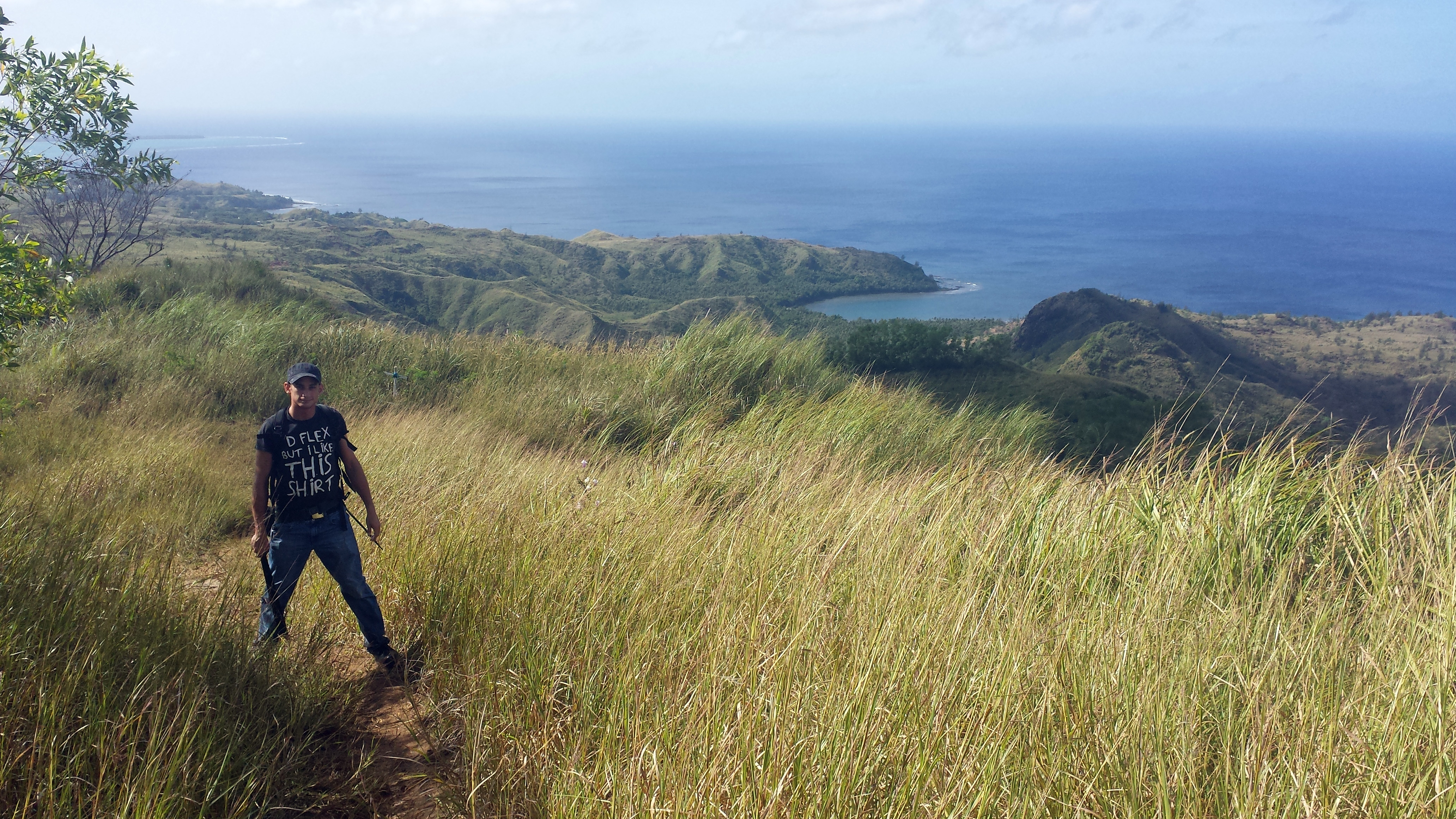
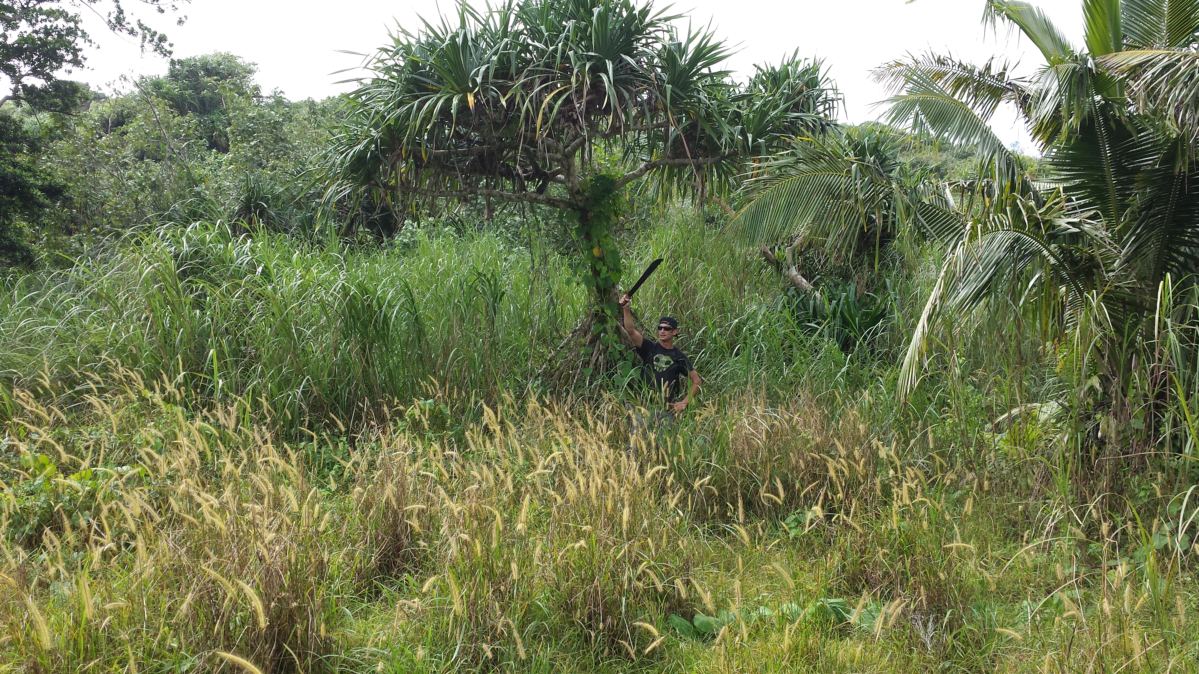
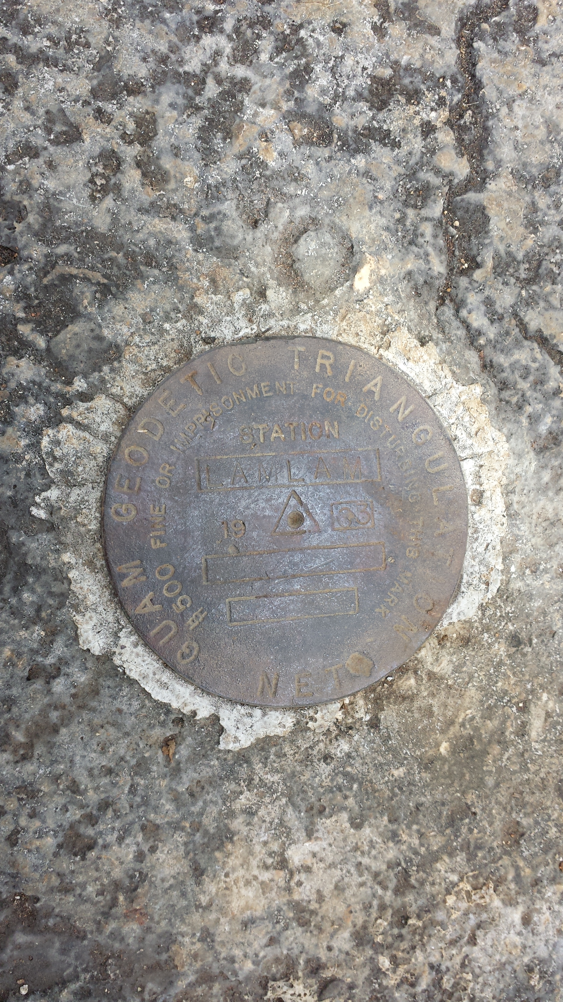
This is me at the top of Mt. Lam Lam. There are not a lot of mountains to climb, so I just climb the same one over and over. Island life, huh?
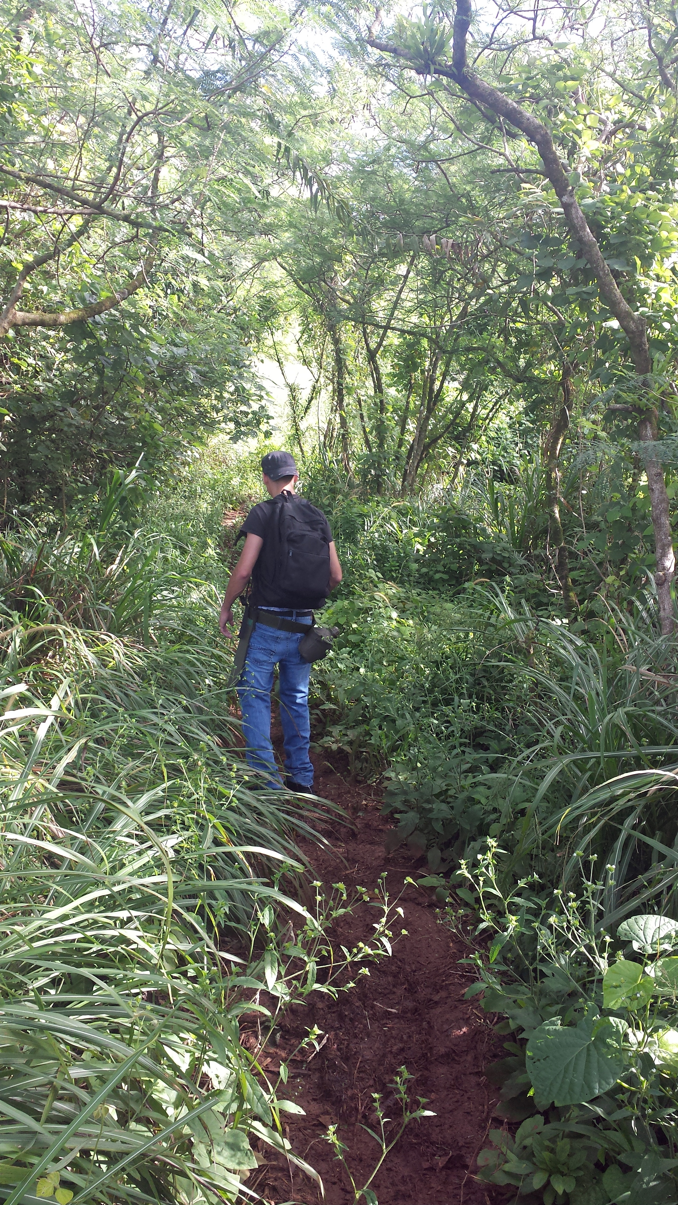
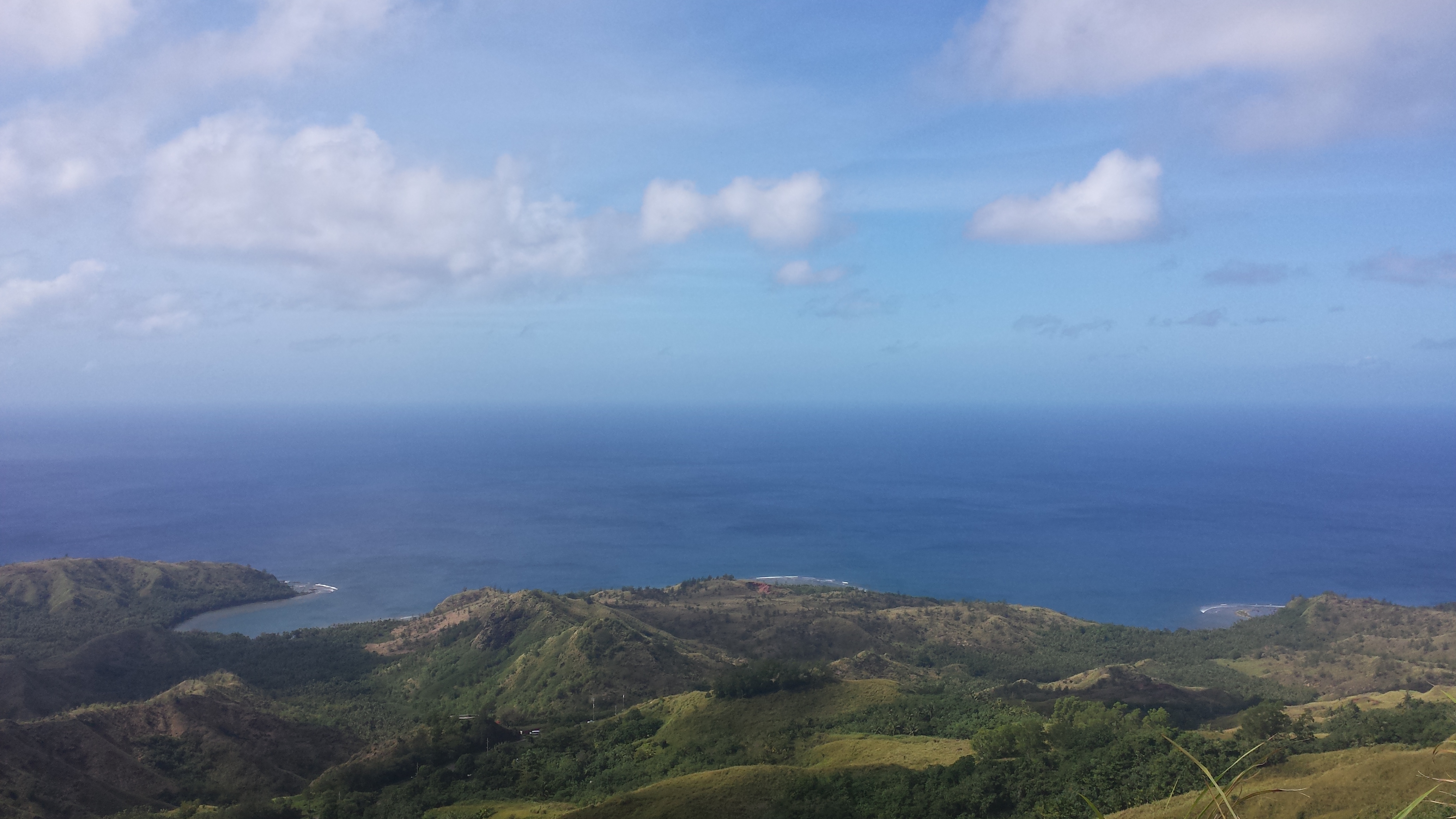
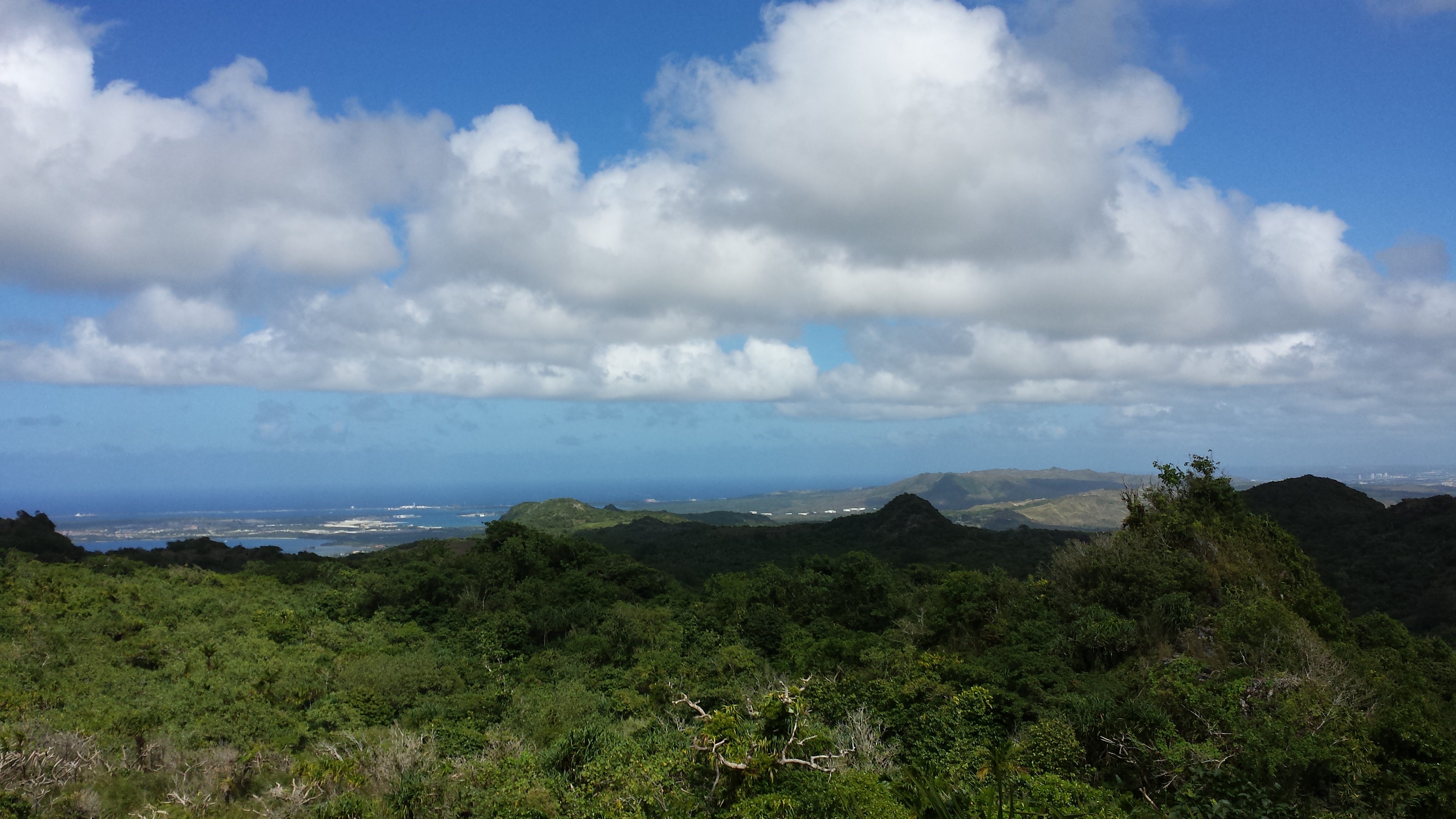
This is the “desert” side of the island down South. There are a lot of trails to valleys with waterfalls and pools to swim in. I like the tall grass and the red dirt. They contrast well with the blue sky and the fluffy clouds.
This is me with the first waterfalls that you come to on the Tarzan Falls hike. They are smaller than the main waterfall, but still pretty.
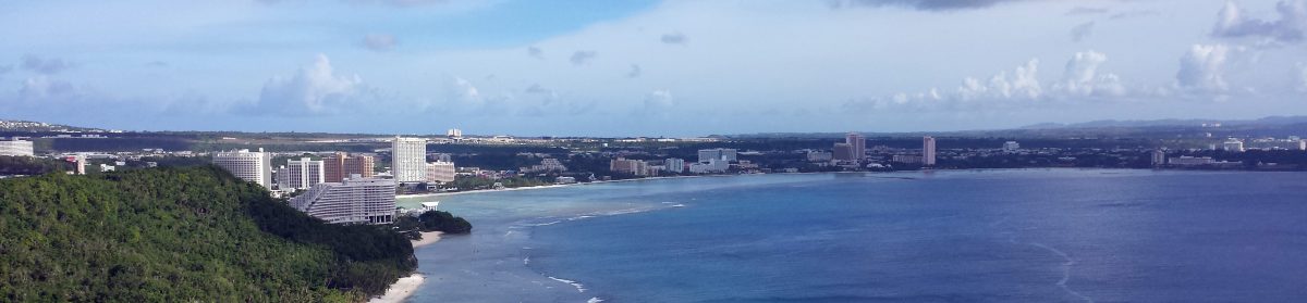
This is Tumon Bay, where we live. It is the most beautiful view I have ever had, and I know we’ll never have such a beautiful view out of our windows again.
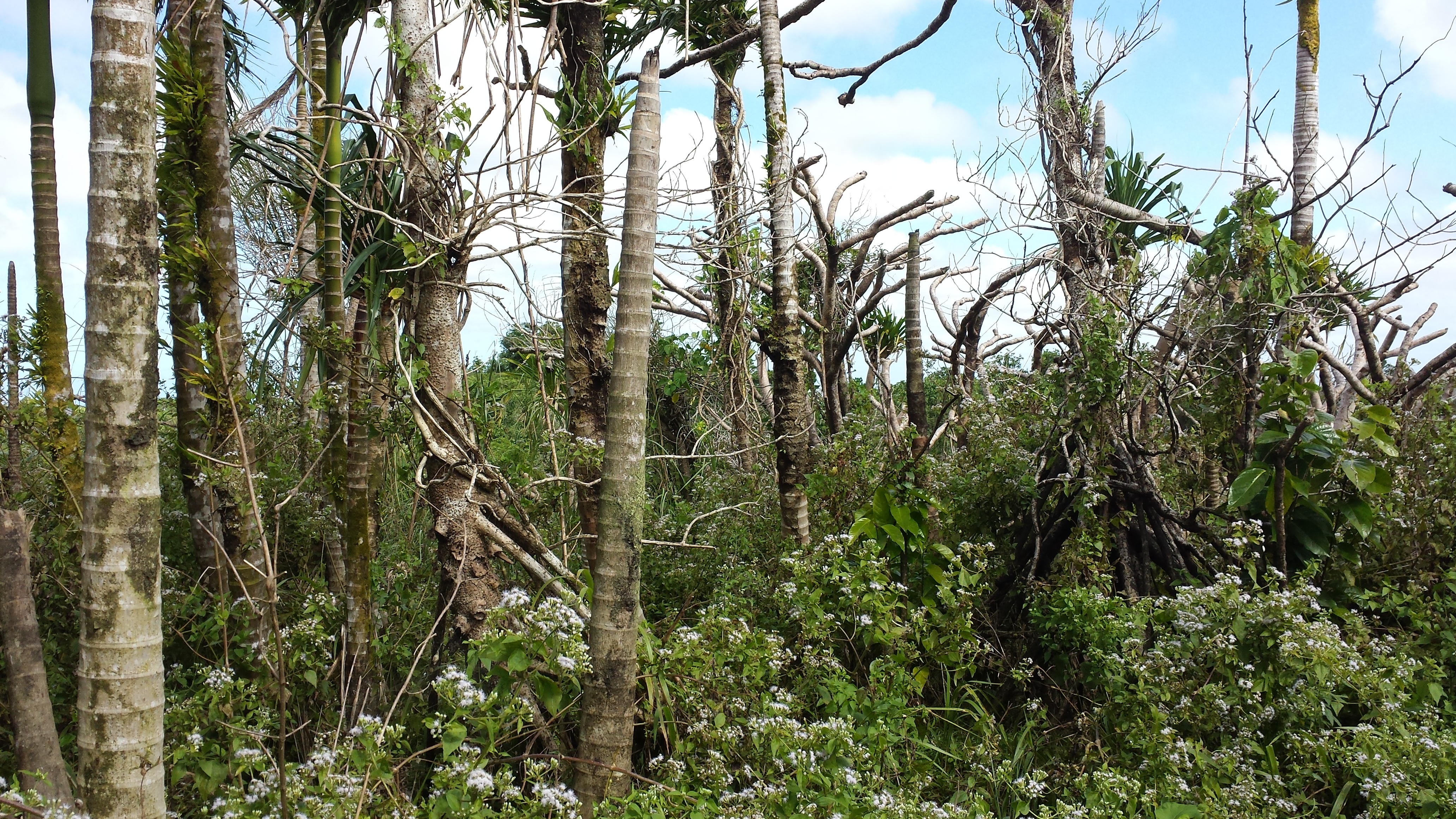
These are wildflowers out on the trail. Usually you just see types of ground orchids, but these pretty lacy flowers are new to me.
Rich and I at Hamamoto Fruit World. It is basically just a really big orchard for tropical fruit trees, but I really liked it because I love plants.
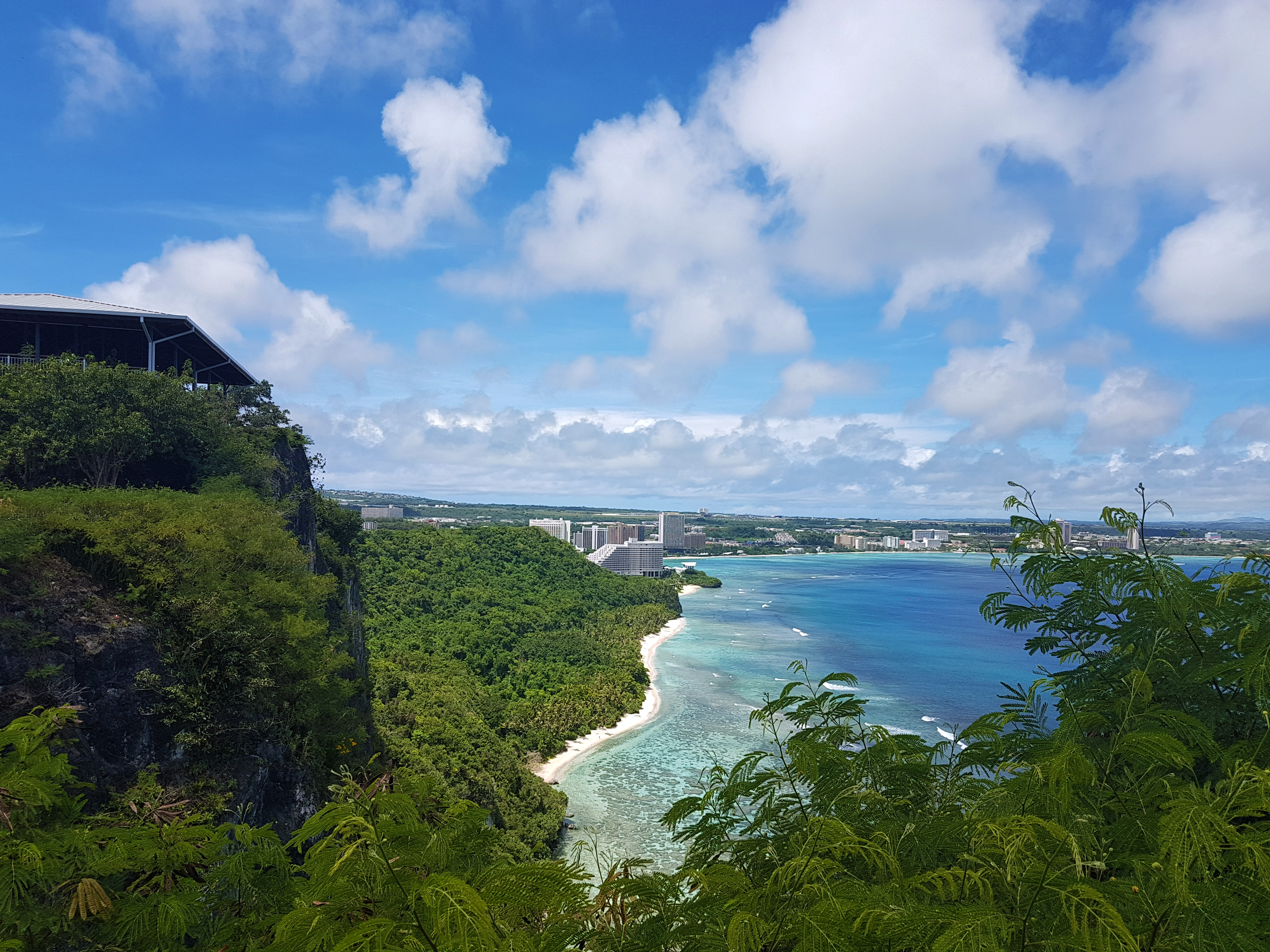
This is the view from Two Lover’s Point. You are looking down at Tumon Bay, and one of the short little buildings in the middle is our condo building.
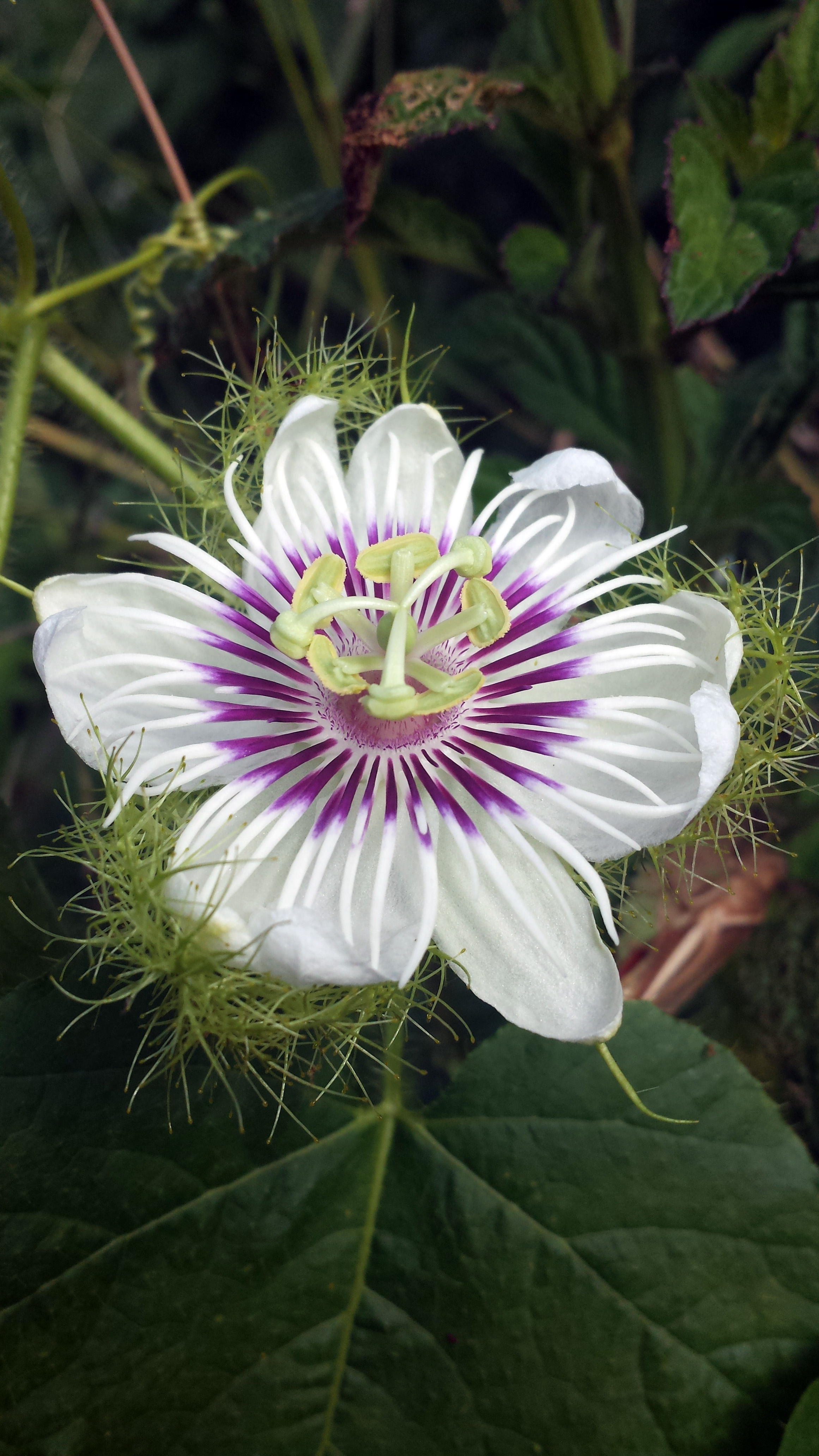
This is my favorite flower. It is called a Passion Flower. They come in different colors. When I was a little girl, my aunt had some that were orange and purple. I loved them. The ones here are mostly white, but they are still pretty.
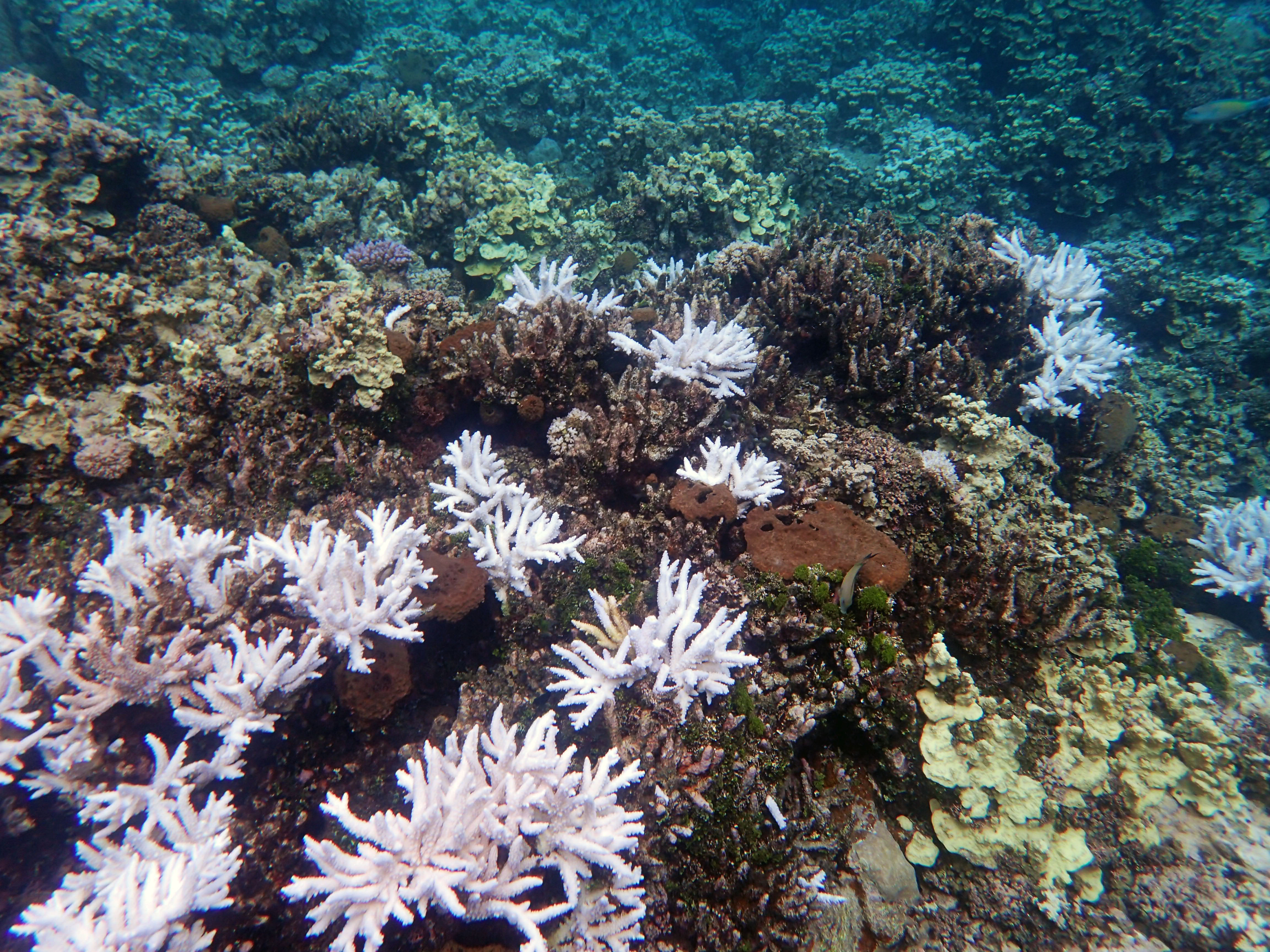
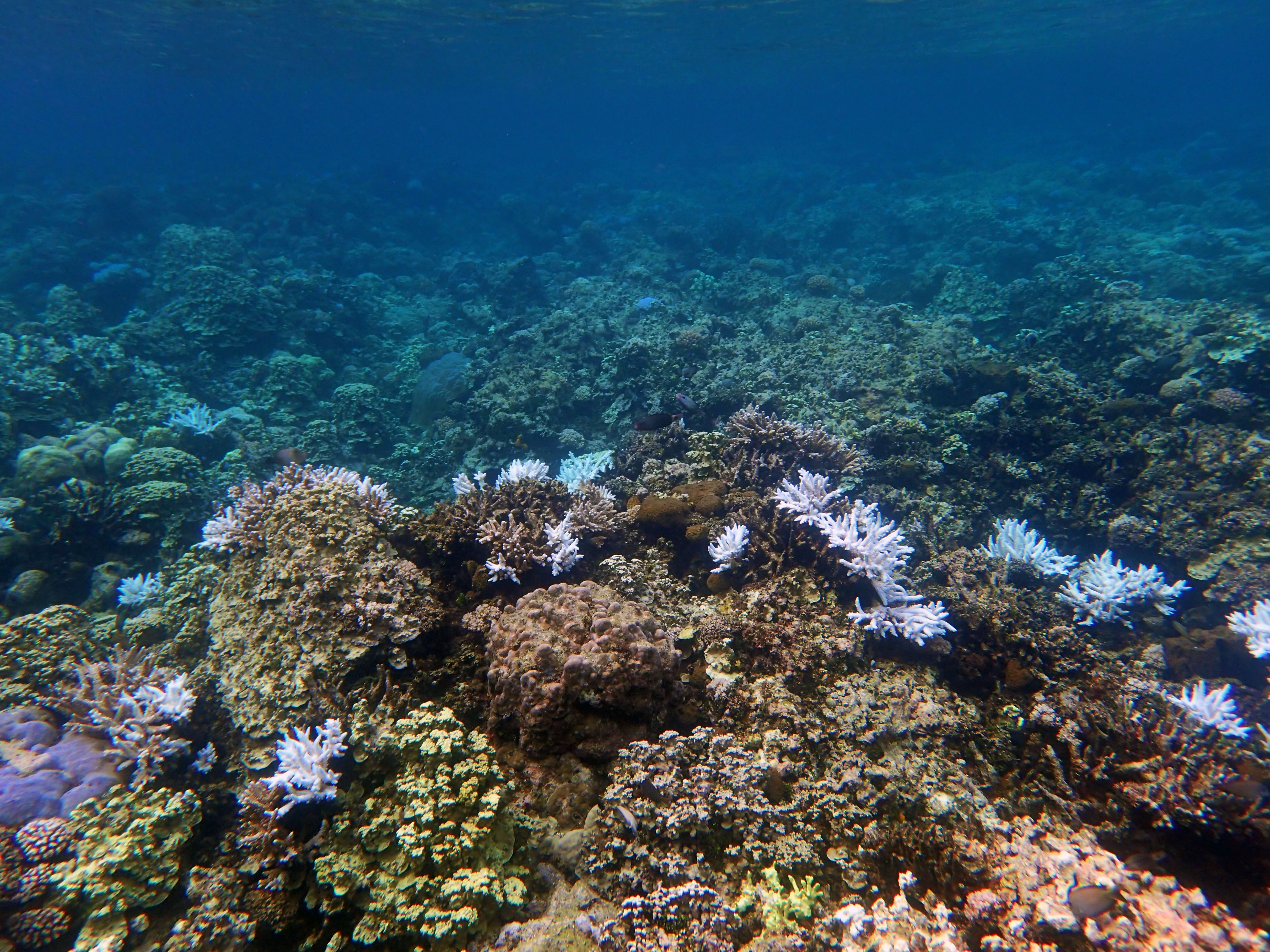
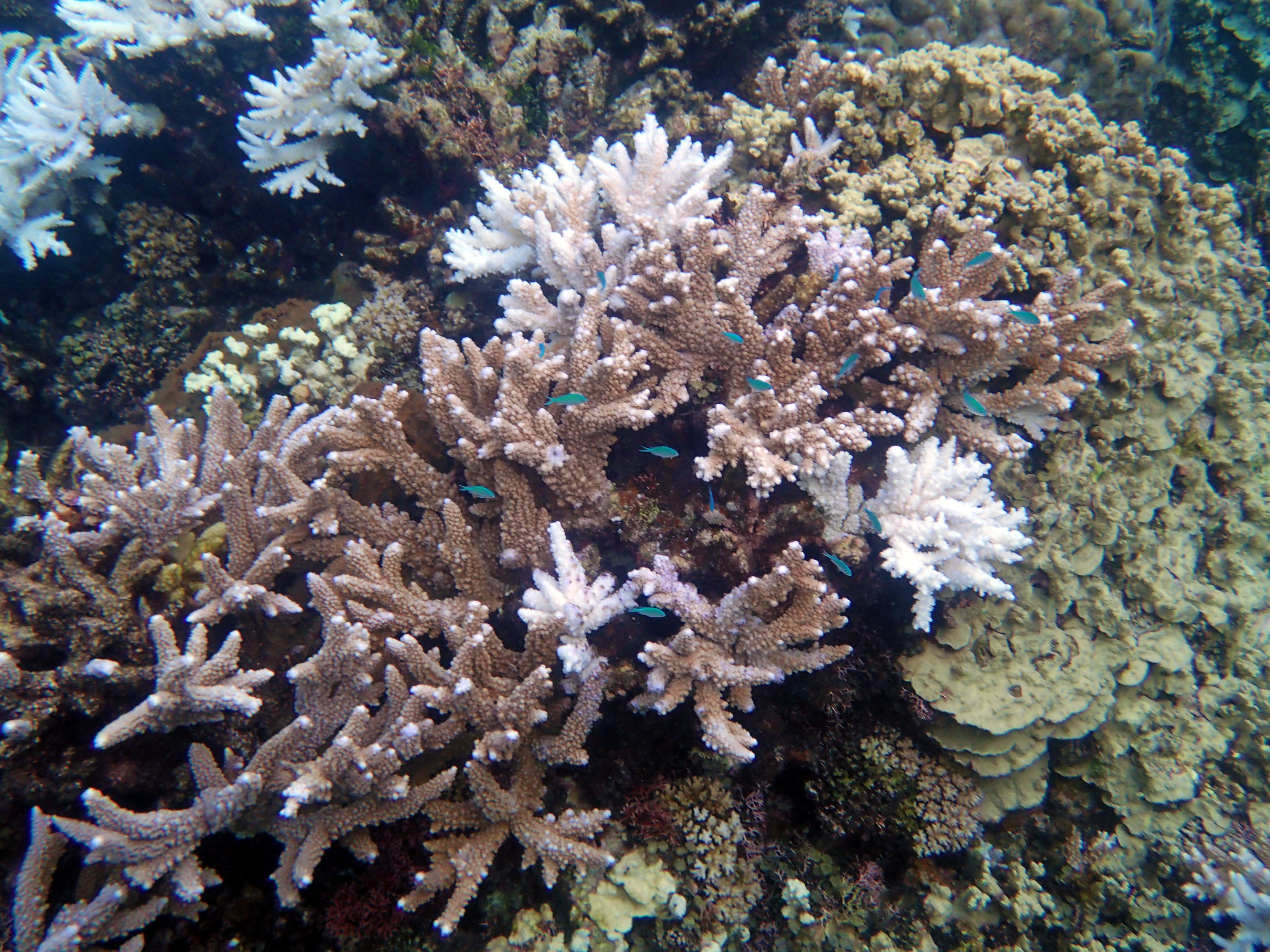
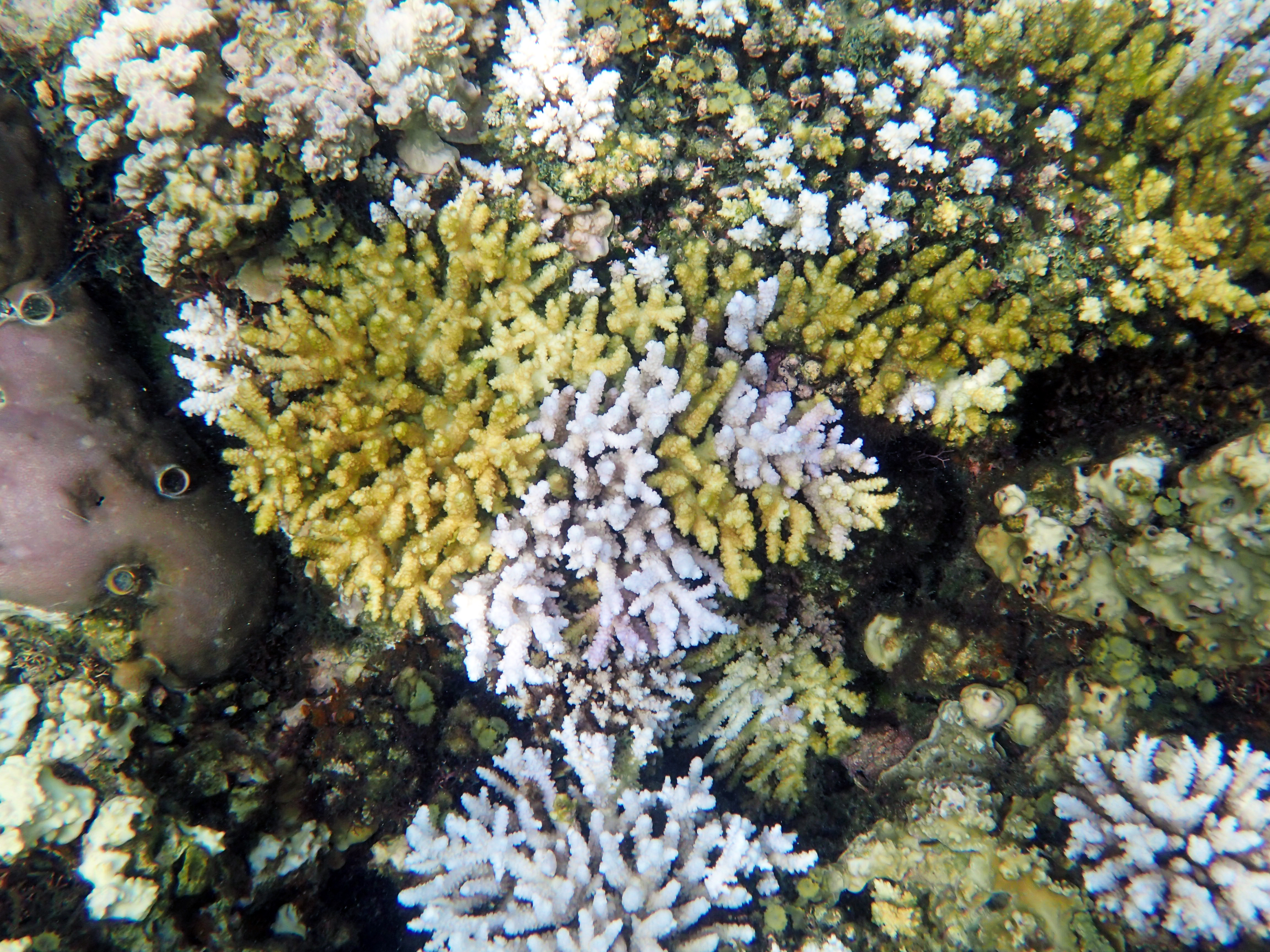
Healthy coral has color to it. In the picture above, you can see healthy coral thriving at Gab Gab reef on May 2nd, 2017. This is what it is supposed to look like.
Unfortunately, the coral around the world is dying, and I want to talk about it for a moment.
Coral is made up of many tiny animals called Polyps.
These little animals have specialized chloroplast cells inside called zooxanthellae. These chloroplasts absorb sunlight and convert it to food for the polyp. Without them, a polyp will die.
When the water temperature in an area gets too hot, the zooxanthellae stop being able to work. They are sensitive to temperature, and so they die.
When they die and the polyp pushes them out, the coral becomes white (since polyps have no color.) Eventually, the polyps die and the coral becomes nothing more than skeletons covered in algae.
The reefs on Guam are bleaching. This is part of a worldwide event, which is being driven by climate change.
I wanted to share these pictures and videos in an effort to draw attention to the fact that this is happening, and how awful it is.
These pictures are taken at Gab Gab, just like the one at the top of the page. The difference is only a few months, but the difference in the temperature in the water is extremely noticeable.
Before, it used to be a little chilly when you first got in. Gab Gab is a reef that goes from the surface water level down more than one hundred feet. Deeper water, in my experience, tends to be colder.
And yet, yesterday when I got in the water, it was hot.
I beg you all to take a very close look.
I think a lot of people who have never been snorkeling or diving are able to easily ignore the bleaching of the corals and the dying of the reefs.
For me, living here, it is much harder.
Coral are home to thousands of species of animals, and as they die, those animals will also die.
The diversity of life that we had in our oceans was amazing, and losing it is absolutely horrifying.
I have no words beautiful enough or sad enough to write the eulogy for our oceans. Nothing said or written could capture how beautiful this reef was just a few months ago.
Seeing the reef now as it bleaches and dies is one of the most painful things I have ever seen.
This hike varies in difficulty depending on the weather. If you go early enough in the morning and it is a windy day, this can be a very nice hike.
If the air is still and you wait until too late in the day, it’s murder.
Either way, bring a lot of sunscreen because there is very little shade.
Also, make sure to have mosquito repellent for any spots you make in the shade. If it has been rainy (and it usually is) you will see a lot of mosquitoes.
There are two tops to Mount Lam Lam, and there is some dispute as to which one is the “real” top.
On the right hand path, you will follow the stations of the cross up to one of the tops of the mountain. This has wonderful views of the ocean and many locals consider it the real top.
However, if you take the left hand path, you will get to the top of the mountain that is officially recognized as the top.
I have done both. The top with the crosses is a much shorter path because it goes straight up.
On the other hand, the surveyors top takes you down into the jungle, and then back up along a poorly marked trial until at last you climb the rocks to the marker.
It’s a beautiful view from either spot, and I recommend doing both (though maybe not in the same day.)
If you are Catholic, you might appreciate the little shrine about halfway up before the trail splits off.
Definitely take some time to enjoy the ground orchids, passion vines, and other beautiful plants.
On an amusing side note: The locals consider Mount Lam Lam to be the tallest mountain in the world because they measure from the bottom of the Marianas Trench to the top of the peak.
Therefore, if you climb Mount Lam Lam, you can amuse your friends by saying you climbed the tallest mountain in the world.